
Country Austria Vehicle registration WT Elevation 410 m Local time Wednesday 4:03 PM Postal code 3820 | Time zone CET (UTC+1) Website www.raabs-thaya.gv.at Area 134.6 km² Population 2,837 (1 Apr 2009) Area code 02846 | |
 | ||
Weather 7°C, Wind NE at 10 km/h, 84% Humidity | ||
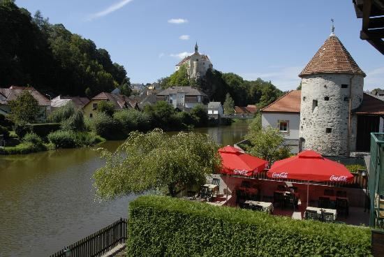
Raabs an der Thaya is a municipality with 3,114 inhabitants in Waidhofen an der Thaya (district) in the Waldviertel of Lower Austria, near the Austrian border with the Czech Republic. About 27.6 percent of the municipality is forested.
Map of 3820 Raabs an der Thaya, Austria
The German Thaya and the Moravian Thaya unite to form the Thaya at Raabs. Raabs castle, built in the last half of the 11th century, has been exonymically called Rakous (formerly Rakús) by neighbouring Czechs, which is the origin of the Czech and Slovak name for Austria as a whole, Rakousko/Rakúsko.
References
Raabs an der Thaya Wikipedia(Text) CC BY-SA