
Admin. region Detmold Elevation 135 m (443 ft) Area 36.27 km² Local time Saturday 10:14 PM | Time zone CET/CEST (UTC+1/+2) Population 9,862 (31 Dec 2010) Postal code 32289 | |
 | ||
Weather 6°C, Wind N at 8 km/h, 77% Humidity | ||
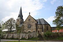
Rödinghausen is a municipality in the district of Herford, in North Rhine-Westphalia, Germany.
Contents
- Map of 32289 RC3B6dinghausen Germany
- Geography
- Neighbouring municipalities
- Division of the municipality
- Mayors
- References
Map of 32289 R%C3%B6dinghausen, Germany
Geography
Rödinghausen is situated on the southern slope of the Wiehengebirge, approx. 20 km north-west of Herford and 25 km north of Bielefeld.
Neighbouring municipalities
Division of the municipality
Rödinghausen consists of 5 villages:
Mayors
References
Rödinghausen Wikipedia(Text) CC BY-SA