
Population 2,580 (2011 census) Postcode(s) 2343 Founded 1856 Local time Wednesday 5:26 AM | Established 1856 Elevation 390 m Postal code 2343 | |
 | ||
Weather 21°C, Wind N at 11 km/h, 86% Humidity | ||
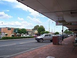
Wotz quirindi nsw australia
Quirindi (/kwəˈrɪndaɪ/ or /kəˈrɪndaɪ/) is a small town on the North West Slopes region of New South Wales, Australia, in Liverpool Plains Shire. At the 2011 census, Quirindi had a population of 2,580. It is the nearest link to Gunnedah to the west and Tamworth to the north. The local economy is based on agriculture, with broadacre farming dominant on the black soil plains to the west and livestock grazing in the hilly eastern part of the district.
Contents
- Wotz quirindi nsw australia
- Map of Quirindi NSW 2343 Australia
- Railway crossing quirindi nsw australia
- History
- Sport
- Quirindi annual events
- Surrounding towns
- Transport
- References
Map of Quirindi NSW 2343, Australia
The town is on the Kamilaroi Highway 15 kilometres (9.3 mi) northwest of its junction with the New England Highway at Willow Tree.
Railway crossing quirindi nsw australia
History
The indigenous Kamilaroi people lived in the area for many thousands of years. The name Quirindi comes from the Gamilaraay language, with a number of meanings having been attributed it, which include "nest in the hills", "place where fish breed" and "dead tree on mountain top". Early spellings of the name included "Cuerindi" and "Kuwherindi".
Quirindi Post Office opened on 1 January 1858. The town was gazetted on 19 February 1884.
Sport
Quirindi sporting facilities include several sporting ovals catering for athletics, cricket (Falcons), Rugby League (Quirindi Grasshoppers), Rugby Union (Quirindi Lions), soccer (Qurindi Football Club- QFC formed in 2011), basketball and netball. Other sporting complexes include the racecourse, polo grounds, rodeo, campdrafting, a 9-hole golf course, two tennis clubs, three bowling greens, gun club and swimming complex.
Quirindi Jockey Club plays host to seven race meetings each year including the Boxing Day Races which attracts thousands of people each year.
A motorcycle club is located 5 kilometres (3.1 mi) north-east of Quirindi on the Borah Creek Road, with a 1.2 kilometres (0.75 mi) motorcross track named Stu Johnson Park.
Quirindi annual events
Surrounding towns
Werris Creek is 20 kilometres (12 mi) north of Quirindi, following the path of the explorer Thomas Mitchell.
Wallabadah is located 15 kilometres (9.3 mi) east of Quirindi on the New England Highway.
Spring Ridge is about 50 kilometres (30 mi) west of Quirindi.
Transport
Quirindi railway station is located on the Main North railway line, 392 kilometres (244 mi) from Sydney. The station opened in 1877, and continues to be served by daily rail services operated by a NSW TrainLink Xplorer train to and from Sydney and Armidale/Moree.
Quirindi Airport is the local airfield, though most commercial flights in the region, go to Tamworth Airport instead.