
Length 7.1 km | ||
 | ||
West end: Welcome Rotonda in Quezon City | ||
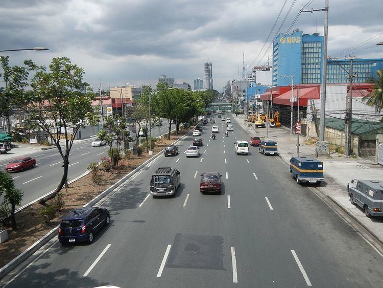
Manuel L. Quezon Avenue, more often called as Quezon Avenue, is a 7.1-kilometer (4.4 mi), 6-14 lane major thoroughfare in Metro Manila named after President Manuel Luis Quezon, the second president of the Philippines. The avenue starts at the Quezon Memorial Circle and runs through to the Welcome Rotonda at the boundary of Quezon City and Manila. Most drivers call the avenue Quezon Ave (pronounced Ke-zon-Av).
Contents
- Map of Quezon Ave Quezon City Metro Manila Philippines
- History
- U turns
- Quezon AvenueAraneta Avenue underpass
- Motorcycle lanes
- Planned expressway
- List of intersections
- Landmarks
- Commercial Structures
- References
Map of Quezon Ave, Quezon City, Metro Manila, Philippines
It is one of the most comfortable roads in Quezon City, lined with palm trees on its center island. Many government and commercial buildings line the road. At its north end, the Triangle Park, one of Quezon City's CBDs, is the third most important industrial center in the city. At its south end, it connects Quezon City to the Philippine's capital - Manila connecting with Eulogio Rodriguez Jr. Avenue. It is a regular route of vehicles from Quezon City leading to Manila, as Quezon Avenue provide access to the Quiapo district of Manila and the University Belt.
History
The road, much like Commonwealth Avenue, was built as part of the road building projects of Ferdinand Marcos. It was named Don Mariano Marcos Avenue to honor Mariano Marcos, the President's father. The road was renamed Quezon Avenue shortly after Marcos's Administration. It originally starts at EDSA, but the portion between the Elliptical Road and EDSA, which used to be named Commonwealth Avenue extension, became a part of the road.
U-turns
On 2003, after the perceived effectiveness in EDSA, Commonwealth Avenue and Marcos Highway, the Metropolitan Manila Development Authority (MMDA) implemented the "clearway scheme"; this has prohibited crossings and left turns on the avenue. In lieu of left turns, the MMDA has constructed U-turn slots 100 to 200 meters away from the intersections to allow vehicles to reach their destination.
Quezon Avenue/Araneta Avenue underpass
On June 2011, a 440-meter (1,440 ft) four-lane underpass was started along the Gregorio Araneta Avenue Intersection. The construction was slated to take up to 15 months. On September 2012, President Benigno Aquino III opened the underpass to the public. The project cost 452 million pesos, or below the 534 million peso-budget allocated for it.
Motorcycle lanes
On 2012, the MMDA instituted motorcycle lanes in the avenue. The lanes are painted blue, and are meant for the exclusive use of motorcycle riders. This comes after the successful use of the "blue lanes" on EDSA, Commonwealth Avenue and Diosdado Macapagal Boulevard, although the blue lane on EDSA is not exclusive to motorcycles.
Planned expressway
There is a planned underground/elevated expressway to be built over Quezon Avenue and Commonwealth Avenue, the R-7 Expressway, a 16.1 km, 4-lane tollroad. Construction might begin in 2016-2018.
List of intersections
Because Quezon Avenue, like Commonwealth Avenue, is a major thoroughfare by vehicles heading to Manila, interchanges were built along the roads. This is the list of intersections of Quezon Avenue, North to South: