
Country Region Orinoquia | Area 12,410 km² Mayor Luis Eduardo Medina Amaya | |
Peculiaridades turisticas de puerto carreno en vichada colombia tvagro por juan gonzalo angel
Puerto Carreño is the departmental capital, and a municipality, of the department of Vichada in the llanos of Colombia.
Contents
- Peculiaridades turisticas de puerto carreno en vichada colombia tvagro por juan gonzalo angel
- Map of Puerto Carreo
- Alcaldia municipal de puerto carreno vichada estamos cumpliendo
- History
- Geography
- Economy
- References
Map of Puerto-Carreño
Alcaldia municipal de puerto carreno vichada estamos cumpliendo
History
In 1913 the Colombian government created the province (comisaria) of Vichada and it was decided that its capital should be at the convergence of the Orinoco and Meta rivers where there was a small village known locally as El Picacho. In 1934 the town was renamed after Pedro Maria Carreño, the Colombian Minister of External Relations from 1912 to 1913. The "municipio" (similar to county in the U.S.) was created in 1974. On July 5, 1991, Vichada's status was updated to "departamento" under the Colombian Constitution and Puerto Carreño was ratified as its capital.
The DANE (Colombian government's bureau for statistics) projected Puerto Carreño's municipal population to be around 10,034 for 2005, based on the 1993 Census. There are some Indigenous tribes within Puerto Carreño's administrative zone as well.
Geography
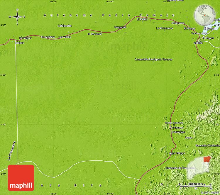
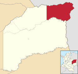
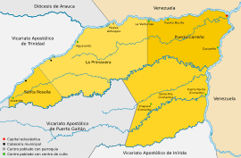
The municipality of Puerto Carreño is located on the extreme northeastern part of the Department of Vichada bordering to the north and east with the Bolivarian Republic of Venezuela using the Meta and Orinoco rivers as borders. To the south Puerto Carreño limits with the municipality of Cumaribo and to the west with the municipality of La Primavera.
The area of the municipality is uniformly flat, although there is a very slight rise at the town which gave it its original name. The climate is hot and dry, with a heavy rain season from April through October averaging a temperature of 28 °C.
The area of the municipality is within the Llanos plains which covers areas in Colombia and Venezuela. Geologically the municipality of Puerto Carreño lies on the Guiana Shield mostly made up by cenozoic and precambric formations, with some low altitude mountains such as the Mounts of Casuarito and the Hormiga and Guaripa mountains.
Economy
Economic activity is based on agricultural and ranching activities, fishing, and mining. There is some international trading activity with Venezuelan towns across the border, across the Orinoco River. Main products in the region are rice, yuca and plantain. Artisan fishing is practiced along ranching. There are gold and silver mines, exploited in a rudimentary way. The municipality often trade commercially with neighboring town of Puerto Páez in Venezuela.