
Airport type Public 1/19 5,000 | Owner Price County Elevation AMSL 1,496 ft / 456 m 5,000 1,524 | |
 | ||
Price county airport committee meeting march 13
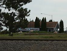
Price County Airport (ICAO: KPBH, FAA LID: PBH) is a county owned public airport located one mile northwest of Phillips, in Price County, Wisconsin, United States. It is included in the Federal Aviation Administration (FAA) National Plan of Integrated Airport Systems for 2017–2021, in which it is categorized as a local general aviation facility.
Contents
Many U.S. airports use the same three-letter location identifier for the FAA and IATA, but this facility is assigned PBH by the FAA and has no designation from the IATA (which assigned PBH to Paro Airport in Paro, Bhutan).
Facilities and aircraft
Price County Airport covers 518 acres (210 ha) at an elevation of 1,496 feet (456 m) above mean sea level. It has two asphalt runways: 1/19 is 5,000 by 75 feet (1,524 x 23 m) and 6/24 is 3,951 by 75 feet (1,204 x 23 m), all with approved GPS approaches.
For the twelve months ending August 26, 2014 the airport had 18,100 aircraft operations, an average of 49 per day: 84% general aviation, 15% air taxi and 1% military. In March 2017, there were 23 aircraft based at this airport: 20 single-engine, 1 multi-engine, 1 jet and 1 ultra-light.