
Length 425 km (264 mi) E/W Highest point Peña Falconera Country Spain | Width 40 km (25 mi) N/S Province Province of Lleida | |
 | ||
Mountains Peña Falconera, Mallos de Riglos, Montsec Range, El Turbón, Corbières Massif Similar Serra del Cadí, Pedraforca, Mallos de Riglos, Port del Comte, Sierra de Guara | ||
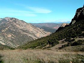
The Pre-Pyrenees are the foothills of the Pyrenees.
Contents
Map of Pre-Pyrenees, 25513, Lleida, Spain
Description
As a mountainous system the Pre-Pyrenees are part of the Pyrenees. They run parallel to the main mountain range in a west to east direction.
On the French side the Pyrenees's slopes descend rather abruptly, thus on the northern side, the Pre-Pyrenees are confined to the Corbières Range, towards the eastern end of the mountain system. The Massif de Plantaurel further west deserves mention as well, although not as clearly a foothill.
On the Iberian side, however, the picture is very different: a large and complex system of foothill ranges stretches from Navarre, across northern Aragon, reaching the Mediterranean coast on the Catalan end of the Pyrenees. At the eastern end on the southern side lies a distinct area known as the Sub-Pyrenees.
Main ranges
Although the highest peaks in the Pre-Pyrenees are not as high as those in the Pyrenees proper, some of the ranges are quite massive, with summits reaching up to 2,600 m (8,500 ft).
Northern slope
Southern slope
The main ranges are: