
- left Waki, Mahalungi - elevation 750 m (2,461 ft) Basin area 6,537 km² | - right Mula - elevation 531 m (1,742 ft) | |
 | ||
- location | ||
Pravara is the smallest of the major tributaries of Godavari river located in Maharashtra, India. Among the 7 major tributaries, it is the only tributary which originates in the Western Ghats akin to Godavari. Also, it is the only major tributary of Godavari to have both its source and confluence located within the same district - Ahmednagar.
Contents
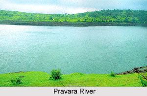
- Map of Pravara River Maharashtra
- Crossing pravara river
- Etymology
- Origin
- Course
- Tributaries
- Dams
- References
Map of Pravara River, Maharashtra
Crossing pravara river
Etymology
As per Indian Vedas, Sage Agastya meditated by consuming only water and air for a long tenure. Due to his incredible devotion, Lord Shiva appeared, blessed him, and left a stream of Ganga that came to be known as the Pravara River.
Origin
The Pravara rises on the eastern slopes of the Sahayadris between Kulang and Ratangad mountains in the Ahmednagar District of Maharashtra.
Course
Close to its origin the river flows into the town of Bhandardara.Here, the Bhandardara Dam is constructed across the river forming the Arthur Lake. The gates of the dam are periodically opened, to allow drownstream flow of the Pravara, giving rise to the Umbrella Falls. From hereon the river takes an east ward course and 58 km downstream, reaches another city- Sangamner, where the river Mahalungi confluences with it. This is the second largest city within the Ahmednagar District. Continuing eastwards, the river is joined by another tributary, this time on its right bank: River Mula. The river,then, reaches the town Nevasa and flows 12 km to the east where it finally empties itself into the Godavari River at Pravara Sangam located 208 km from its source of origin.
Tributaries
In its short run, the river acquires water from two main tributaries : Mahalungi and Mula.