
East end: ND 200 at Fairview | Length 1,137 km | |
 | ||
West end: SH 200 northwest of Heron Major cities Missoula, Great Falls, Glendive, Lewistown Counties Richland County, Montana, Dawson County, Montana | ||
Montana highway 200
Highway 200 (MT 200) in the U.S. state of Montana is a route running east-west covering the entire state of Montana. From the starting point at ID 200, near Heron, Montana the highway runs east to ND 200 near Fairview, Montana. It is part of a chain of state highways numbered 200 which extend from Idaho across Montana, North Dakota and Minnesota. Montana Highway 200 is also the longest route signed as a state highway in the United States.
Contents
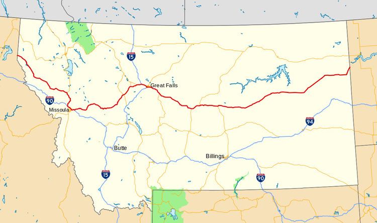
Map of MT-200, Montana, USA
Highway 200 helps to connect many small towns located in central Montana and the vast plains area of eastern Montana, to larger western Montana cities such as Great Falls and Missoula.
The highway runs parallel to the Blackfoot River from McNamara to Milltown. The highway is subject to hazardous driving conditions in the winter, particularly due to black ice. The road crosses Rogers Pass on the continental divide on its way west to Missoula.
At its western end, west of Missoula, Highway 200 follows the Clark Fork River eastward at the feet of the Cabinet Mountains until it meets the Flathead River at MT 135. It then follows the Flathead River east to Dixon where the Flathead River turns north. Highway 200 continues east following the Jocko River until it intersects with US 93 at Ravalli. The highway then bends south to join I-90 going east into Missoula.
Related route
Montana Highway 200S is a spur route of MT 200 that branches off of the main route near Circle and ends at I-94 in Glendive.