
Max. length 2.6 mi (4.2 km) Area 176 ha Length 4.2 km | Primary inflows Basin countries United States Surface elevation 206 m Mean depth 90 cm | |
 | ||
Similar Contoocook Lake, Thorndike Pond, Franklin Pierce Lake, Powwow Pond, Lake Massasecum | ||
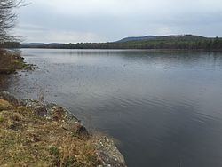
Powder Mill Pond is a 419-acre (1.70 km2) impoundment on the Contoocook River in Hillsborough County in southern New Hampshire, United States. The pond's dam is located in the town of Bennington, with water impounded into the towns of Hancock and Greenfield.
Map of Powder Mill Pond, New Hampshire, USA
The lake is classified as a warmwater fishery, with observed species including smallmouth and largemouth bass, chain pickerel, horned pout, black crappie, and bluegill.
References
Powder Mill Pond Wikipedia(Text) CC BY-SA