
Length 114 km | ||
 | ||
Sources Contoocook Lake, Pool Pond | ||
Learning to fly fish in contoocook river nh
The Contoocook River is a 71-mile-long (114 km) river in New Hampshire. It flows from Pool Pond and Contoocook Lake on the Jaffrey/Rindge border to Penacook (just north of Concord), where it empties into the Merrimack River. It is one of only a few rivers in New Hampshire that flow in a predominantly northward direction. Two picturesque covered bridges in Hopkinton and one in Henniker span the Contoocook, as does another on the Hancock-Greenfield line. Residents and tourists have made the Contoocook popular for fishing and whitewater boating.
Contents
- Learning to fly fish in contoocook river nh
- Map of Contoocook River New Hampshire USA
- Life on the contoocook river
- Principal tributariesEdit
- References
Map of Contoocook River, New Hampshire, USA
The name Contoocook came from the Pennacook tribe of Native Americans and means "place of the river near pines". Other variations of the name include the Abenaki meaning "nut trees river" or Natick language meaning "small plantation at the river".
The river gives its name to Contoocook, New Hampshire, a census-designated place (CDP) within the town of Hopkinton.
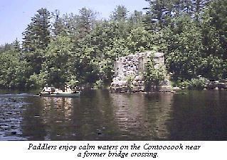
Life on the contoocook river
Principal tributariesEdit
From south to north: