
Population 0 | Coordinates . | |
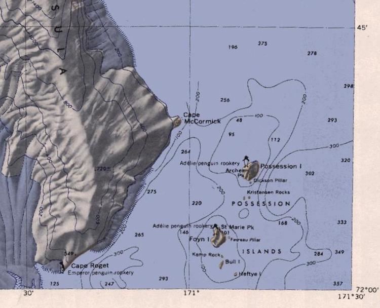 | ||
The Possession Islands are a group of small islands and rocks extending over an area of about 7 miles (11 km), lying in the western part of the Ross Sea, 5 miles (8 km) southeast of Cape McCormick, Victoria Land. The Possession Islands were named by Captain James Clark Ross, Royal Navy, in commemoration of the planting of the British flag here on January 12, 1841.
Contents
Map of Possession Islands, Antarctica
Possession Island
Possession Island is a rocky island nearly 2 miles (3.2 km) long, which is the northernmost and largest of the Possession Islands. Possession Island is located at 71°52′S 171°12′E. Archer Peak is a peak on the southernmost edge of Possession Island.
References
Possession Islands Wikipedia(Text) CC BY-SA