
Local time Friday 4:50 AM | ||
 | ||
Weather 3°C, Wind S at 13 km/h, 75% Humidity | ||
Port Burwell is a community on the north shore of Lake Erie, in the municipality of Bayham in Elgin County, Ontario, Canada. It is situated at the mouth of Big Otter Creek.
Contents
Map of Port Burwell, ON, Canada
History
Originally part of Bayham Township, Port Burwell was surveyed in 1830 by Mahlon Burwell, surveyor for land grant recipient Colonel Thomas Talbot. A bustling port and rail terminal for much of its history, Port Burwell was incorporated as a village in 1949. It was reamalgamated with Bayham and the Village of Vienna to form an expanded Township of Bayham in 1998.
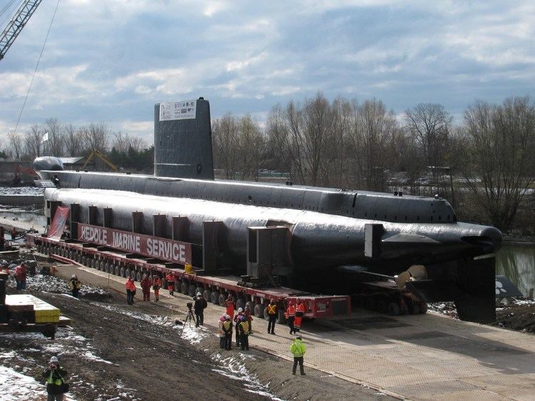
In November 2012, HMCS Ojibwa—a retired 'cold war' submarine—was placed in a permanent site in Port Burwell as part of the Museum of Naval History.
References
Port Burwell, Ontario Wikipedia(Text) CC BY-SA