Settled 1800s Time zone EST (UTC-5) Population 6,989 (2011) | Incorporated January 1, 1850 Postal Code N0J Local time Tuesday 12:02 PM Number of airports 1 | |
 | ||
Weather 9°C, Wind SE at 16 km/h, 72% Humidity Points of interest Big Otter Creek, Port Burwell Marine Museum and Historic Lighthouse, HMCS Ojibwa | ||
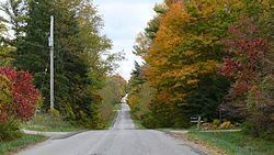
Bayham (2011 Population: 6,989) is a municipality in the southeast corner of Elgin County, Ontario, Canada. It is south of the town of Tillsonburg and Oxford County.
Contents
Map of Bayham, ON, Canada
History
Bayham was named in 1810 for Viscount Bayham Charles Pratt, a friend of land grant recipient Colonel Talbot. The township was incorporated on January 1, 1850. The villages of Port Burwell and Vienna were incorporated as separate municipalities and separated from the township in 1949 and 1853 respectively.
In 1998, Bayham was re-amalgamated with Port Burwell and Vienna to form an expanded Township of Bayham.
Communities
The municipality comprises the communities of Corinth, Eden, Froggetts Corners, North Hall, Port Burwell, Richmond, Springer's Hill, Straffordville, Vienna and Wadger.
Demographics
Population trend:
