
Postal index 93300—93354 Founded 1923 | Established 1977 Time zone EET (UTC+2) Area 1,466 km² Population 40,696 (2013) Area code 6474 | |
 | ||
Subdivisions List 1 — city councils 7 — settlement councils3 — rural councilsNumber of localities: 1 — cities 7 — urban-type settlements17 — villages 10 — rural settlements | ||
Popasna Raion (Ukrainian: Попаснянський район) is a raion (district) in Luhansk Oblast of eastern Ukraine. The administrative center is the town of Popasna. Population: 40,696 (2013 est.).
Contents
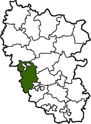
Map of Popasnyans'kyi district, Luhansk Oblast, Ukraine
History
On 7 October 2014, to facilitate the governance of Luhansk Oblast, the Verkhovna Rada made some changes in the administrative divisions, so that the localities in the government-controlled areas were grouped into districts. In particular, the urban-type settlement of Chornukhyne was transferred to Popasna Raion from Perevalsk Raion, the urban-type settlement of Novotoshkivske from Kirovsk Municipality, and the towns of Hirske and Zolote and the urban-type settlements of Nyzhnie and Toshkivka from Pervomaisk Municipality.
Demographics
As of the 2001 Ukrainian census:
References
Popasna Raion Wikipedia(Text) CC BY-SA