
Population 3,227 (2011) Civil parish Pontesbury Local time Thursday 9:48 PM | OS grid reference SJ397061 Dialling code 01743 | |
 | ||
Weather 4°C, Wind NE at 18 km/h, 80% Humidity | ||
Shropshire hills the view from earl s hill pontesbury
Pontesbury is a large village and civil parish in Shropshire and is approximately eight miles southwest of the county town of Shrewsbury. In the 2011 census, its population was 3,227. The village of Minsterley is just over a mile further southwest. The A488 road runs through the village, on its way from Shrewsbury to Bishop's Castle. The Rea Brook flows close by to the north with the village itself nestling on the northern edge of the Shropshire Hills AONB.
Contents
- Shropshire hills the view from earl s hill pontesbury
- Map of Pontesbury Shrewsbury UK
- Pontesbury hurricane
- Local Government
- Education
- Other Public Amenities and Services
- Industries and Trade
- Churches
- Hill
- Famous residents
- Sports Clubs
- References
Map of Pontesbury, Shrewsbury, UK
Pontesbury hurricane
Local Government
The village is the seat of an extensive civil parish, with its own parish council grouped into five wards, representing the village and outlying areas such as the villages and hamlets of Pontesford, Plealey, Asterley, Cruckton, Cruckmeole, Arscott, Lea Cross, Malehurst etc, as well as Habberley (which was previously a civil parish in its own right until 1967). It hosts an official Pontesbury Parish website. It is represented on the unitary Shropshire Council and in parliament in the Shrewsbury and Atcham constituency.
Education
The village is home of a comprehensive school, the Mary Webb School and Science College, named after the local novelist Mary Webb, which serves most of the surrounding villages for pupils age 11–16, on whose premises is the Mary Webb Sports Centre, usable by the public out of school hours. There is also a primary school, on whose premises also meet a pre-school playgroup formed 1990. There is also a nursery school, for children aged 3 months to 4 years, called The Ark, on Hall Bank.
Other Public Amenities and Services
The village contains a medical practice, dental surgery, post office, police station (under F Division, West Mercia Police), public library, public hall and cemetery.
Industries and Trade
The village has a long mining history, once linked to Snailbeach and Hanwood via the Minsterley branch line and the Snailbeach District Railways, it supplied local industry with coal, lead, iron and stone. Although the railway tracks are no longer there, the route that it took can still be walked, where some stations and sidings remain. Nearby Poles Coppice, around half-a-mile south of the village, contains two former quarries and is now a countryside recreation area.
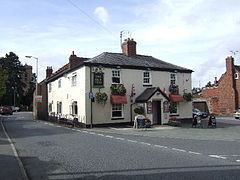
Pontesbury is one of the largest villages in Shropshire and so is host to a wide range of local services including independent local shops selling local produce and three public houses ('The Horseshoes', 'The Nag's Head' and 'The Plough').
Churches
In the centre of the village sits St George's Church of England parish church, the origins of which can be traced to about 1250 AD but due to the site's circular graveyard shape may indicate a much more ancient site of Anglo Saxon or even Celtic origin. The church itself however was largely restored in the 19th century, following the collapse of the mediaeval tower between 1820 and 1825. For a village, population c 3,000, it is large, and has a very active and lively congregation. St George's is open to all during daylight hours, but is closed at night.
The churchyard contains the outdoor parish war memorial. The present Portland stone cross, erected 1963, replaced an earlier elaborate cross by Temple Lushington Moore and unveiled in 1921, which bore a crucifix and images of the Virgin Mary, Mary Magdalene and St George and the Dragon but had become dilapidated and was dismantled in 1960.
There are also active Baptist, Methodist and Congregationalist Churches. The Salvation Army had a barracks in Pontesbury between about 1888–1894.
Hill
Nearby is Earls Hill, which is the site of an Iron Age hillfort built around 600 B.C. and making it a Scheduled Ancient Monument and also designated an SSSI (Site of Special Scientific Interest) for its wildlife value. It was Shropshire Wildlife Trust's first nature reserve in 1964. Earls Hill is PreCambrian in origin, being formed approximately 650 million years ago as a result of volcanic activity along the Pontesford-Linley fault.
Famous residents
Mary Webb (1881–1927), author of 'Precious Bane', 'The Golden Arrow' and 'Gone to Earth' lived at Pontesbury for a time, along with other villages in Shropshire. She and her husband rented Rose Cottage, during which time she wrote 'The Golden Arrow' (published 1916), and later another at The Nills. The latter book was inspired by a local legend involving a search for gold, in the form of a golden arrow, which takes place every Palm Sunday, on top of Earls Hill.
Pontesbury was also visited by D. H. Lawrence and later appeared in his novel St Mawr.
Wolverhampton Wanderers and Welsh international footballer David Edwards was born in and attended school in the village.
Sports Clubs
These include: