
OS grid reference SJ373070 Post town SHREWSBURY Local time Monday 7:21 PM | Sovereign state United Kingdom Postcode district SY5 Dialling code 01743 | |
 | ||
Weather 3°C, Wind SW at 10 km/h, 86% Humidity | ||
Asterley is a village in Shropshire, England. Its name, derived from Old English, means "the eastern clearing in the forest".
Map of Asterley, Shrewsbury, UK
It was historically a township of the large parish of Pontesbury, and is still part of the civil parish of Pontesbury. It consists of some 50 houses, including some timber- and cruck-framed dwellings.
There is a brick former Church of England mission church in the village, built in 1869 but a private house since about 1990,. Its churchyard contains the graves of two World War II soldiers who both died in 1940, which are registered and maintained by the Commonwealth War Graves Commission.
There is a functioning Primitive Methodist chapel, built in 1834. A stone World War I memorial tablet is next to its entrance door outside and indoors is a framed Roll of Honour to local men who died in World War II. The village had a small and possibly shortlived Latter Day Saints congregation in 1851.
The village has had two pubs, The Royal Oak and The Windmill Inn, a shop and a school house which are all now private houses.
In the 18th and 19th centuries the village was the centre of a small-scale coal mining and brick-making industry.
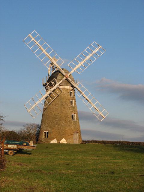
Outside the village is a rare survival, a windmill built in 1809. It was restored in the 1980s.