
Founded December 22, 1845 Area 1,927 km² | Congressional district 5th Website www.co.polk.or.us Population 76,794 (2013) | |
 | ||
Destinations | ||
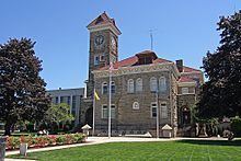
Polk County is a county located in the U.S. state of Oregon. As of the 2010 census, the population was 75,403. The county seat is Dallas. The county is named for James Knox Polk, the 11th president of the United States.
Contents
- Map of Polk County OR USA
- History
- Geography
- Adjacent counties
- National protected areas
- 2000 census
- 2010 census
- Politics
- Economy
- Cities
- Census designated places
- References
Map of Polk County, OR, USA
Polk County is part of the Salem, OR Metropolitan Statistical Area, which is also included in the Portland-Vancouver-Salem, OR-WA Combined Statistical Area. It is located in the Willamette Valley.
History
The Oregon Provisional Legislature created Polk County from Yamhill District on December 22, 1845, granting to it the entire southwestern portion of present-day Oregon to the California border. County boundaries were periodically changed to reflect the creation of Benton and Lincoln counties. Many other counties were subsequently carved out of these as settlement spread towards the south, leaving Polk County many counties away from its former border with California.
The first county seat was a settlement on the north side of Rickreall Creek named Cynthian (also known as Cynthia Ann). In 1852 city officials renamed Cynthian to Dallas after Vice President George M. Dallas, vice president (1845-1849) to James Polk. During the 1880s and 1890s, there were a series of unsuccessful efforts to move the county seat to nearby Independence.
Geography
According to the U.S. Census Bureau, the county has a total area of 744 square miles (1,930 km2), of which 741 square miles (1,920 km2) is land and 3.1 square miles (8.0 km2) (0.4%) is water.
About two thirds of Polk County, the western part, is forest, mostly of the coniferous and mixed varieties, bordering on temperate rain forest around Laurel Mountain, the wettest place in Oregon.
The eastern half of the county lies in the Willamette Valley. The Willamette River forms the eastern border of the county, separating it from neighboring Marion County.
Adjacent counties
National protected areas
2000 census
As of the census of 2010, there were 75,403 people, 28,288 households, and 19,545 families residing in the county. The population density was 102 people per square mile (39/km²). There were 30,302 housing units at an average density of 41 per square mile (16/km²). The racial makeup of the county was 85.9% White, 0.6% Black or African American, 2.1% Native American, 1.9% Asian, 0.3% Pacific Islander, 5.4% from other races, and 3.8% from two or more races. 12.1% of the population were Hispanic or Latino of any race.
There were 28,288 households out of which 32.4% had children under the age of 18 living with them, 54.2% were married couples living together, 10.3% had a female householder with no husband present, and 30.9% were non-families. 23% of all households were made up of individuals and 9.8% had someone living alone who was 65 years of age or older. The average household size was 2.60 and the average family size was 3.06.
In the county, the population was spread out with 24.3% under the age of 18 and 14.8% 65 years of age or older. The median age was 37.1 years. For every 100 females there were 94.8 males. For every 100 females age 18 and over, there were 91.8 males.
As of the 2000 census, the median income for a household in the county was $42,311, and the median income for a family was $50,483. Males had a median income of $36,667 versus $26,272 for females. The per capita income for the county was $19,282. About 6.30% of families and 11.50% of the population were below the poverty line, including 12.50% of those under age 18 and 5.50% of those age 65 or over.
2010 census
As of the 2010 United States Census, there were 75,403 people, 28,288 households, and 19,545 families residing in the county. The population density was 101.8 inhabitants per square mile (39.3/km2). There were 30,302 housing units at an average density of 40.9 per square mile (15.8/km2). The racial makeup of the county was 85.9% white, 2.1% American Indian, 1.9% Asian, 0.6% black or African American, 0.3% Pacific islander, 5.4% from other races, and 3.8% from two or more races. Those of Hispanic or Latino origin made up 12.1% of the population. In terms of ancestry, 22.4% were German, 16.4% were English, 10.4% were Irish, and 6.4% were American.
Of the 28,288 households, 32.4% had children under the age of 18 living with them, 54.2% were married couples living together, 10.3% had a female householder with no husband present, 30.9% were non-families, and 23.0% of all households were made up of individuals. The average household size was 2.60 and the average family size was 3.06. The median age was 37.1 years.
The median income for a household in the county was $50,975 and the median income for a family was $61,418. Males had a median income of $46,616 versus $35,371 for females. The per capita income for the county was $24,345. About 8.8% of families and 12.9% of the population were below the poverty line, including 17.2% of those under age 18 and 6.8% of those age 65 or over.
Politics
Though Polk County is located in western Oregon, politically it falls in line with the eastern side of the state. The majority of registered voters who are part of a political party in Polk County, as well as most rural counties in Oregon, are members of the Republican Party. In the 2012 presidential election, 50.54% of Polk County voters voted for Republican Mitt Romney, while 46.21% voted for Democrat Barack Obama, and 3.25% either voted for a Third Party candidate or wrote in a candidate. These numbers show a shift toward the Republican candidate when compared to the 2008 presidential election, in which 48.92% of Polk County voters voted for Republican John McCain, while 48.43% voted for Barack Obama, and 2.64% either voted for a Third Party candidate or wrote in a candidate.
Economy
The major industries of the county are agriculture, forest products, manufacturing, and education. Polk County has the second-largest area devoted to viticulture in Oregon, at 1,322 acres (5.35 km2). Western Oregon University in Monmouth is a major employer.