
OS grid reference SE065155 Post town HUDDERSFIELD Dialling code 01422 | Sovereign state United Kingdom | |
 | ||
Region | ||
Pole moor annual 2015
Pole Moor is a hamlet between Outlane and Scammonden in Kirklees, England. It is situated on a high moorland plateau between Slaithwaite and Wholestone Moors in the South Pennines.
Contents
- Pole moor annual 2015
- Map of Pole Moor Huddersfield UK
- Pole moor to slaithwaite road march 26 2013
- History
- Geography
- Inns
- References
Map of Pole Moor, Huddersfield, UK
Pole moor to slaithwaite road march 26 2013
History
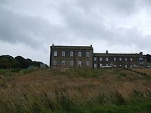
At the start of the Industrial Revolution the inhabitants were woollen weavers. When the Earl of Dartmouth objected to a chapel being built on his land at Slaithwaite, the Baptists built their chapel on the edge of Worts Hill in 1790. After closing in 1992, the chapel, Sunday school and an adjoining late-19th century warehouse were converted into housing and are Grade II listed buildings.
The Huddersfield to Rochdale turnpike road of 1806, the A640 passes over Pole Moor where there was an inn, the Royal George, and where several pack horse routes crossed, including one from Halifax to Marsden and on to Lancashire.
Geography
Scammonden Reservoir in the Deanhead Valley is to the west, the M62 motorway passes to the north and to the south 700 feet (210 m) below Moorside Edge is Slaithwaite in the Colne Valley. Moorside Edge medium wave radio transmitter's antenna are located at 340 metres (1,120 ft) OD on the moor. An old bridle way passed over the moor to Scammonden at Worts Hill to the west.
Inns
Among the hamlet's public houses were the Lower Royal George and the Upper Royal George which was built in 1457 as the Royal George Inn and renamed the Jack O' Mitre in the 1980s. The Sun Inn was demolished. The Nont Sarah Hotel is being refurbished as a community hub.