
Country United States Zip code 99759 Area code 907 | State Alaska FIPS code 02-61700 Population 247 (2000) | |
 | ||
Area 89.35 km² (78.99 km² Land / 10.36 km² Water) | ||
Point Lay (Kali in Inupiaq- "Mound") is a census-designated place (CDP) in North Slope Borough, Alaska, United States. At the 2000 census the population was 247.
Contents
- Map of Point Lay AK USA
- My pad in point lay alaska
- Geography and climate
- Demographics
- Lifestyle and economy
- Military radar
- References
Map of Point Lay, AK, USA
My pad in point lay alaska
Geography and climate
Point Lay is located at 69°44′28″N 163°0′31″W (69.741023, -163.008613) on the shores of the Chukchi Sea.
According to the United States Census Bureau, the CDP has a total area of 34.5 square miles (89 km2), of which, 30.5 square miles (79 km2) of it is land and 4.0 square miles (10 km2) of it (11.66%) is water.
Point Lay once was on a barrier island of Kasegaluk Lagoon, but moved to the mainland near the mouth of the Kokolik River during the 1970s.
Demographics
As of the 2010 United States Census, there were 189 people residing in the CDP. The racial makeup of the CDP was 88.4% Native American, 10.1% White, 0.5% Pacific Islander and 0.5% from two or more races. 0.5% were Hispanic or Latino of any race.
As of the census of 2000, there were 247 people, 61 households, and 45 families residing in the CDP. The population density was 8.1 people per square mile (3.1/km2). There were 67 housing units at an average density of 2.2 per square mile (0.8/km2). The racial makeup of the CDP was 11.34% White, 82.59% Native American, 0.40% Asian, and 5.67% from two or more races. 2.43% of the population were Hispanic or Latino of any race.
There were 61 households out of which 50.8% had children under the age of 18 living with them, 45.9% were married couples living together, 18.0% had a female householder with no husband present, and 24.6% were non-families. 23.0% of all households were made up of individuals and 1.6% had someone living alone who was 65 years of age or older. The average household size was 3.93 and the average family size was 4.57.
In the CDP, the age distribution of the population shows 46.2% under the age of 18, 9.3% from 18 to 24, 24.7% from 25 to 44, 17.0% from 45 to 64, and 2.8% who were 65 years of age or older. The median age was 21 years. For every 100 females there were 135.2 males. For every 100 females age 18 and over, there were 133.3 males.
The median income for a household in the CDP was $68,750, and the median income for a family was $75,883. Males had a median income of $46,071 versus $25,625 for females. The per capita income for the CDP was $18,003. About 11.4% of families and 7.4% of the population were below the poverty line, including 8.1% of those under the age of eighteen and none of those sixty five or over.
Lifestyle and economy
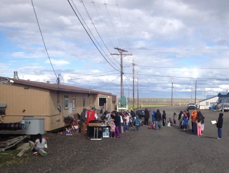
The village has an annual hunt of Beluga Whales within the Kasegaluk Lagoon. On the Fourth of July, a parade runs through town led by the fire engines and ambulances of the town's modern fire department.
The Eskimo name for the village was Kali, which means "mound", after a raised area on the barrier island where the old village stood. The school and fire department bear the name Kali.
The Kali school is a part of the North Slope Borough School District.
Military radar
Until recently, a cluster of radar dishes existed near Point Lay. These were a part of the Distant Early Warning Line, a system of defensive radar installations built during the Cold War. The station was decommissioned during the 1990s, and the radar dishes were dismantled sometime between 2004 and 2006.