
Area 98 ha Local time Tuesday 9:27 AM | Population 109 (2013) | |
 | ||
Weather 11°C, Wind NE at 13 km/h, 74% Humidity | ||
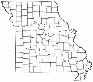
Plato is an incorporated village in northwestern Texas County, Missouri, United States. It is located about 20 miles northwest of Houston, Missouri and 10 miles south of Fort Leonard Wood on Route 32. The population was 109 at the 2010 census.
Contents
- Map of Plato MO 65552 USA
- History
- Geography
- 2010 census
- Mean center of the United States
- Transportation
- Media
- Education
- Notable person
- References
Map of Plato, MO 65552, USA
As of the 2010 U.S. Census Plato is the Mean center of United States population of the distribution of the U.S. population.
History
The community was founded in 1874 and is named after the ancient Greek philosopher Plato.
The Bates-Geers House was listed on the National Register of Historic Places in 1982.
Geography
According to the United States Census Bureau, the village has a total area of 0.38 square miles (0.98 km2), all of it land.
2010 census
As of the census of 2010, there were 109 people, 41 households, and 35 families residing in the village. The population density was 286.8 inhabitants per square mile (110.7/km2). There were 48 housing units at an average density of 126.3 per square mile (48.8/km2). The racial makeup of the village was 95.4% White, 1.8% African American, 1.8% Native American, and 0.9% from other races. Hispanic or Latino of any race were 4.6% of the population.
There were 41 households of which 36.6% had children under the age of 18 living with them, 65.9% were married couples living together, 12.2% had a female householder with no husband present, 7.3% had a male householder with no wife present, and 14.6% were non-families. 14.6% of all households were made up of individuals and 9.8% had someone living alone who was 65 years of age or older. The average household size was 2.66 and the average family size was 2.83.
The median age in the village was 36.5 years. 28.4% of residents were under the age of 18; 7.4% were between the ages of 18 and 24; 23% were from 25 to 44; 17.4% were from 45 to 64; and 23.9% were 65 years of age or older. The gender makeup of the village was 49.5% male and 50.5% female.
Mean center of the United States
In March 2011 Plato was declared the 2010 Mean center of United States population based on 2010 Census data.
The report of Plato as being the mean center was first reported on the Wikipedia mean center page in December 21, 2010 – nearly 3 months before the census officially declared it. The report got quite wide coverage after being reported in the Houston, Missouri Herald article and a Connecticut Public Radio broadcast. Reports subsequently said that Alex Zakrewsky, a planner from Middlesex County, New Jersey claimed to have been the source for the Wikipedia article. Zakrewsky said he had plugged the 2010 numbers into a spreadsheet he developed using year 2000 data to calculate the center. He said that a colleague posted it to Wikipedia. His calculation placed it to the west of the community on Robidoux Creek, 3.2 miles off the official Census report which placed it on the east side of the community (37.517534°N 92.173096°W / 37.517534; -92.173096).
The mean center has been moving southwest through Missouri about 20 to 30 miles per decade since 1980 when it was near DeSoto, Missouri. In 2000 it was near Edgar Springs, Missouri.
Transportation
Waynesville Regional Airport at Forney Field serves the community with air service. Even though it's on Fort Leonard Wood, it is jointly run by the cities of Waynesville and St. Robert and is available for civilian use by private pilots and scheduled commercial passenger service.
Media
The Fort Leonard Wood area has one daily and three weekly print newspapers, as well as an online internet daily newspaper. South of the post, the Houston Herald [1] covers Texas County issues but doesn't regularly cover Plato village or school issues.
KFBD-FM and its AM sister station, KJPW, are the news radio providers in the Pulaski County area, which includes Fort Leonard Wood as well as northern Texas County. These stations compete with the only other station broadcasting from Pulaski County, KFLW Radio, owned by the Lebanon Daily Record [2] and working locally from the St. Robert offices of the Pulaski County Mirror [3] weekly newspaper.
The Daily Guide, commonly known as the Waynesville Daily Guide [4] but based in St. Robert and serving all of Pulaski County, is owned by Gatehouse Media [5] and is the central printing plant for three other Gatehouse newspapers in nearby counties, the daily Camden Lake Sun Leader [6] and Rolla Daily News [7] as well as the weekly St. James Leader-Journal.[8] The Daily Guide covers school sports and the occasional big story in Plato.
The content of the weekly Fort Leonard Wood Guidon [9] is produced under the auspices of Army Public Affairs at Fort Leonard Wood but printed under contract by the Springfield News-Leader,[10] a Gannett-owned [11] newspaper which produces and sells advertisements in the Fort Leonard Wood Guidon. The military contract to produce the Guidon was held by the Lebanon Daily Record until the end of 2002, and before the Lebanon Daily Record had been held by the Waynesville Daily Guide for many years.
Education
The areas south of Fort Leonard Wood, including the unincorporated Pulaski County communities of Big Piney and Palace, are served by the Plato R-V School District,[12] which is based in the northern Texas County village of Plato but also includes parts of Pulaski, Laclede and Wright counties.
Nearby school districts in Success, Manes and Gasconade, are K-8 districts which don't have a high school. Some students from those districts attend Plato High School after finishing school in their own district.
Fort Leonard Wood is in Pulaski County and a high percentage of military personnel live off post in surrounding communities, especially St. Robert and Waynesville but also the farther-out cities of Richland, Crocker, and Dixon, and the unincorporated communities of Laquey, Swedeborg and Devil's Elbow, all of which have a lower housing cost than nearer housing in St. Robert and Waynesville. Military personnel assigned to training areas on the south end of the post sometimes choose to live in the unincorporated areas of Big Piney and Palace in Pulaski County, or the northern Texas County communities of Plato and Roby.
Seven main school districts are fully or partly within the borders of Pulaski County, not counting two small districts which are mostly within other counties and only have only a few dozen residents within Pulaski County. All seven school districts have a high percentage of Fort Leonard Wood military dependents, and over two-thirds of Waynesville students fall into that category.
Notable person
Fort Leonard Wood is the birthplace of screenwriter Josh Senter who is known for his work on Desperate Housewives.