
Country United States County Pulaski FIPS code 29-65144 Elevation 317 m Local time Saturday 1:09 AM | Time zone Central (CST) (UTC-6) GNIS feature ID 0752006 Population 5,163 (2013) | |
 | ||
Weather 12°C, Wind SE at 13 km/h, 89% Humidity Area 20.31 km² (20.28 km² Land / 3 ha Water) University Central College of Cosmetology | ||
St. Robert is a city in Pulaski County, Missouri, United States. The population was 4,340 at the 2010 census. It is a gateway community to the United States Army Maneuver Support Center of Excellence Fort Leonard Wood. The city is named after the local Catholic parish, whose patron saint Robert Bellarmine was an important early Jesuit.
Contents
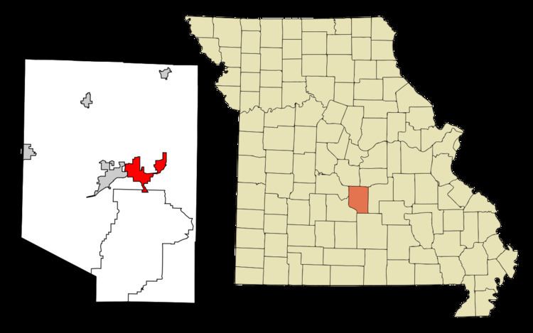
- Map of St Robert MO USA
- Geography
- 2010 census
- 2000 census
- Transportation
- Local
- Media
- School Districts
- References
Map of St Robert, MO, USA
Geography
St. Robert is located at 37°49′28″N 92°8′1″W (37.824550, -92.133499).
According to the United States Census Bureau, the city has a total area of 7.84 square miles (20.31 km2), of which, 7.83 square miles (20.28 km2) is land and 0.01 square miles (0.03 km2) is water. Historic Route 66 runs through St. Robert.
2010 census
As of the census of 2010, there were 4,340 people, 1,827 households, and 1,080 families residing in the city. The population density was 554.3 inhabitants per square mile (214.0/km2). There were 1,992 housing units at an average density of 254.4 per square mile (98.2/km2). The racial makeup of the city was 61.1% White, 22.1% African American, 0.4% Native American, 5.8% Asian, 0.9% Pacific Islander, 3.1% from other races, and 6.7% from two or more races. Hispanic or Latino of any race were 11.0% of the population.
There were 1,827 households of which 36.1% had children under the age of 18 living with them, 41.9% were married couples living together, 13.1% had a female householder with no husband present, 4.1% had a male householder with no wife present, and 40.9% were non-families. 35.2% of all households were made up of individuals and 5.3% had someone living alone who was 65 years of age or older. The average household size was 2.36 and the average family size was 3.09.
The median age in the city was 30.1 years. 28% of residents were under the age of 18; 10.4% were between the ages of 18 and 24; 36.9% were from 25 to 44; 18.7% were from 45 to 64; and 6.1% were 65 years of age or older. The gender makeup of the city was 51.1% male and 48.9% female.
2000 census
As of the census of 2000, there were 2,760 people, 1,219 households, and 688 families residing in the city. The population density was 383.0 people per square mile (147.8/km²). There were 1,408 housing units at an average density of 195.4 per square mile (75.4/km²). The racial makeup of the city was 64.64% White, 20.29% African American, 0.58% Native American, 5.43% Asian, 0.40% Pacific Islander, 2.90% from other races, and 5.76% from two or more races. Hispanic or Latino of any race were 6.12% of the population.
There were 1,219 households out of which 31.3% had children under the age of 18 living with them, 39.7% were married couples living together, 12.1% had a female householder with no husband present, and 43.5% were non-families. 36.5% of all households were made up of individuals and 6.0% had someone living alone who was 65 years of age or older. The average household size was 2.25 and the average family size was 2.98.
In the city, the population was spread out with 26.9% under the age of 18, 7.8% from 18 to 24, 37.3% from 25 to 44, 20.0% from 45 to 64, and 8.0% who were 65 years of age or older. The median age was 33 years. For every 100 females there were 99.7 males. For every 100 females age 18 and over, there were 101.5 males.
The median income for a household in the city was $33,080, and the median income for a family was $37,841. Males had a median income of $29,934 versus $20,625 for females. The per capita income for the city was $17,650. About 11.3% of families and 11.3% of the population were below the poverty line, including 15.0% of those under age 18 and 5.6% of those age 65 or over.
Transportation
Waynesville Regional Airport at Forney Field serves the community with air service; even though it's on Fort Leonard Wood, it is jointly run by the cities of Waynesville and St. Robert and is available for civilian use by private pilots and scheduled commercial passenger service.
The major east-west route is Interstate 44; before that, the main highway was U.S. Route 66, which still exists as a scenic route through the area and passes through Devil's Elbow, St. Robert, Waynesville, Buckhorn, and Hazelgreen. Names for U.S. Route 66 vary - at different places, it's called Teardrop Road, Highway Z, Old Route 66, Historic Route 66, and Highway 17. State-posted signs mark most of the alignment of the road.
Major north-south routes near St. Robert include:
Local
St. Robert has a mayor and eight aldermen, each elected for two-year terms. The city has four wards with two aldermen elected from each ward in staggered terms so one alderman from each ward stands for election each year while the mayor is elected citywide. As with most other Missouri cities, elections are held in April.
Non-elected senior positions include Interim City Administrator Anita Ivey and City Clerk Debbie Adkins. Municipal Judge Tom Julian was re-elected in April 2009 to the position he had held for many years; the city council subsequently converted the municipal judge position to an appointed rather than an elected position and reappointed Julian to the position. Following Julian's death, Bill Hardwick, an assistant prosecuting attorney working under County Prosecutor Kevin Hillman, a former St. Robert city attorney, was appointed to fill the position.
Hillman and former Ward II Alderman Gene Newkirk both left city government following the results of the August 2010 elections. Hillman was elected as the Pulaski County Prosecuting Attorney; Newkirk was elected the Pulaski County Presiding Commissioner.
The following chart reflects the city's elected officials following the April 2014 municipal election in which incumbent Larry Jackson was defeated by challenger Theresa Cook, herself a former alderman who was defeated for re-election several years earlier. Reggie Hall was appointed to fill a vacancy caused by the resignation of Butchy Newkirk and George Lauritson, himself a former mayor, ran unopposed for a seat when Freda Hunnicutt decided not to run for re-election. The positions remained unchanged in the 2013 municipal election from those who had been elected in 2014.
Media
Pulaski County has one daily and three weekly print newspapers, as well as an online internet daily newspaper. The county also has an internet discussion site, the Pulaski County Insider.
KFBD-FM and its AM sister station, KJPW, are the dominant news radio providers in the Pulaski County area, which includes Fort Leonard Wood, Waynesville, and St. Robert. These stations compete with the only other station broadcasting from Pulaski County, KFLW Radio, owned by the Lebanon Daily Record [1] and working locally from the St. Robert offices of the Pulaski County Mirror [2] weekly newspaper.
The Daily Guide, commonly known as the Waynesville Daily Guide [3] but based in St. Robert and serving the entire county, is owned by GateHouse Media [4] and is the central printing plant for three other GateHouse newspapers in nearby counties, the daily Camden Lake Sun Leader [5] and Rolla Daily News [6] as well as the weekly St. James Leader-Journal.[7]
The content of the weekly Fort Leonard Wood Guidon [8] is produced under the auspices of Army Public Affairs at Fort Leonard Wood but printed under contract by the Springfield News-Leader,[9] a Gannett-owned [10] newspaper which produces and sells advertisements in the Fort Leonard Wood Guidon. The military contract to produce the Guidon was held by the Lebanon Daily Record until the end of 2002, and before the Lebanon Daily Record had been held by the Waynesville Daily Guide for many years.
The weekly Pulaski County Mirror [11] is owned by the Lebanon Daily Record,[12] a family owned newspaper in an adjoining county. The paper is a merger of the Richland Mirror and Pulaski County Democrat in St. Robert, which were separate weekly papers owned by the Lebanon Daily Record until their owner merged them in 2009.
The Pulaski County Daily News [13] internet newspaper is privately owned by a Waynesville resident.
The Pulaski County Insider [14] is run and maintained by a businessman from St. Robert and hosted by a Potosi resident.
The other weekly paper in Pulaski County, the Dixon Pilot, does not routinely cover St. Robert.
School Districts
St. Robert residents attend the Waynesville R-VI School District[15]
Fort Leonard Wood is in Pulaski County and a high percentage of military personnel live off post in surrounding communities, especially St. Robert and Waynesville.
Seven main school districts are fully or partly within the borders of Pulaski County, not counting two small districts which are mostly within other counties and only have only a few dozen residents within Pulaski County. All seven school districts have a high percentage of Fort Leonard Wood military dependents, and over two-thirds of Waynesville students fall into that category.
The cities of Waynesville and St. Robert and the Fort Leonard Wood army installation, along with their surrounding rural areas running east to Devil's Elbow, are served by the Waynesville R-VI School District[16] which is by far the largest in the county.
Other school districts serving Pulaski County include the Laquey R-V School District, Richland R-IV School District, Swedeborg R-III School District, Crocker R-II School District and Dixon R-I School District. The Plato R-V School District is in northern Texas County but serves Pulaski County residents living south of the post.