
Country United States FIPS code 29-17344 Elevation 344 m Zip code 65452 Local time Saturday 12:53 PM | Time zone Central (CST) (UTC-6) GNIS feature ID 0716505 Area 3.21 km² Population 1,115 (2013) Area code 573 | |
 | ||
Weather 20°C, Wind SW at 19 km/h, 21% Humidity | ||
Crocker is a city in Pulaski County, Missouri, United States. The population was 1,110 at the 2010 census.
Contents
- Map of Crocker MO 65452 USA
- History
- Geography
- 2010 census
- 2000 census
- Transportation
- School Districts
- References
Map of Crocker, MO 65452, USA
History
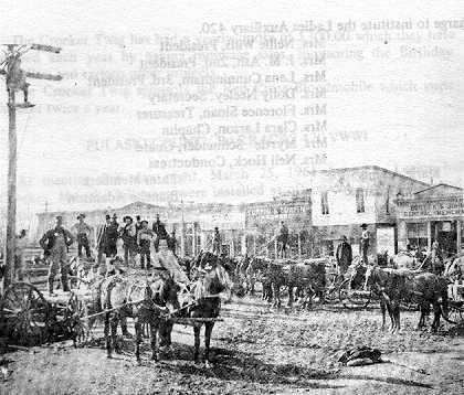
Crocker was platted in 1869, and named after a railroad promoter. A post office called Crocker has been in operation since 1872.
Geography
Crocker is located at 37°56′58″N 92°15′56″W (37.949542, -92.265660).
According to the United States Census Bureau, the city has a total area of 1.24 square miles (3.21 km2), all of it land.
2010 census
As of the census of 2010, there were 1,110 people, 433 households, and 278 families residing in the city. The population density was 895.2 inhabitants per square mile (345.6/km2). There were 525 housing units at an average density of 423.4 per square mile (163.5/km2). The racial makeup of the city was 95.9% White, 0.5% African American, 0.8% Native American, 0.1% Asian, 0.5% from other races, and 2.3% from two or more races. Hispanic or Latino of any race were 2.8% of the population.
There were 433 households of which 39.3% had children under the age of 18 living with them, 45.5% were married couples living together, 11.3% had a female householder with no husband present, 7.4% had a male householder with no wife present, and 35.8% were non-families. 31.6% of all households were made up of individuals and 13.9% had someone living alone who was 65 years of age or older. The average household size was 2.55 and the average family size was 3.21.
The median age in the city was 33.5 years. 29.9% of residents were under the age of 18; 7.7% were between the ages of 18 and 24; 25.5% were from 25 to 44; 23.1% were from 45 to 64; and 13.6% were 65 years of age or older. The gender makeup of the city was 49.8% male and 50.2% female.
2000 census
As of the census of 2000, there were 1,033 people, 425 households, and 277 families residing in the city. The population density was 868.4 people per square mile (335.2/km²). There were 517 housing units at an average density of 434.6 per square mile (167.7/km²). The racial makeup of the city was 97.29% White, 0.29% African American, 1.36% Native American, 0.39% Pacific Islander, 0.10% from other races, and 0.58% from two or more races. Hispanic or Latino of any race were 0.68% of the population.
There were 425 households out of which 36.2% had children under the age of 18 living with them, 49.4% were married couples living together, 11.1% had a female householder with no husband present, and 34.8% were non-families. 32.5% of all households were made up of individuals and 15.8% had someone living alone who was 65 years of age or older. The average household size was 2.41 and the average family size was 3.04.
In the city the population was spread out with 28.4% under the age of 18, 8.2% from 18 to 24, 29.4% from 25 to 44, 16.9% from 45 to 64, and 17.0% who were 65 years of age or older. The median age was 36 years. For every 100 females there were 89.9 males. For every 100 females age 18 and over, there were 85.5 males.
The median income for a household in the city was $29,583, and the median income for a family was $35,750. Males had a median income of $26,964 versus $16,141 for females. The per capita income for the city was $13,401. About 13.9% of families and 17.5% of the population were below the poverty line, including 22.1% of those under age 18 and 19.2% of those age 65 or over.
Transportation
Waynesville Regional Airport at Forney Field serves the community with air service; even though it's on Fort Leonard Wood, it is jointly run by the cities of Waynesville and St. Robert and is available for civilian use by private pilots and scheduled commercial passenger service.
The major east-west route is Interstate 44; before that, the main highway was U.S. Route 66, which still exists as a scenic route through the area and passes through Devil's Elbow, St. Robert, Waynesville, Buckhorn, and Hazelgreen. Names for U.S. Route 66 vary - at different places, it's called Teardrop Road, Highway Z, Old Route 66, Historic Route 66, and Highway 17. State-posted signs mark most of the alignment of the road.
Major north-south routes near Crocker include:
School Districts
Fort Leonard Wood is in Pulaski County and a high percentage of military personnel live off post in surrounding communities, especially St. Robert and Waynesville but also the farther-out cities of Richland, Crocker, and Dixon, and the unincorporated communities of Laquey, Swedeborg and Devil's Elbow, all of which have a lower housing cost than nearer housing in St. Robert and Waynesville. Military personnel assigned to training areas on the south end of the post sometimes choose to live in the unincorporated areas of Big Piney and Palace in Pulaski County, or the northern Texas County communities of Plato and Roby.
Seven main school districts are fully or partly within the borders of Pulaski County, not counting two small districts which are mostly within other counties and only have only a few dozen residents within Pulaski County. All seven school districts have a high percentage of Fort Leonard Wood military dependents, and over two-thirds of Waynesville students fall into that category.
The city of Crocker, along with the surrounding rural areas, is served by the Crocker R-II School District [1].
Other school districts serving Pulaski County are the Laquey R-V School District, Richland R-IV School District, Swedeborg R-III School District, and Dixon R-I School District. While located in northern Texas County, the Plato R-V School District serves Pulaski County residents living south of the post.