
Elevation 4,107 m | Last eruption 1998 Parent range Andes | |
 | ||
Similar Volcán Planchón, Descabezado Grande, Tupungatito, Cerro Azul, Antuco | ||
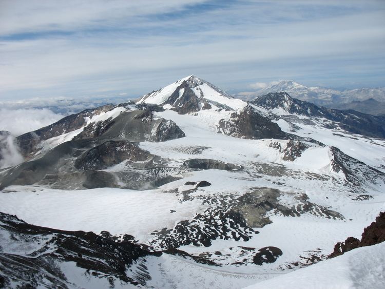
Planchón-Peteroa is a complex volcano extending in a north-south direction along the border between Argentina and Chile. It consists of volcanoes of various ages with several overlapping calderas. Those include Volcán Planchón, Volcán Peteroa and Volcán Azufre.
Contents
Map of Volc%C3%A1n Peteroa, Argentina
A partial collapse of the complex about 11,500 years ago produced a major debris avalanche, which followed the course of the Teno River until reaching the Chile Central Valley.
Peteroa has a crater lake. Lagunas de Teno lies at the foot of Planchón volcano. In this area also is the Vergara International Pass.
September 6, 2010 eruption
Planchón-Peteroa Volcano erupted on September 6 followed by a stronger eruption on September 18. On September 21, the volcano erupted once again emitting a dark gray plume of ash. As winds cause volcanic ash to blow southeast into Argentina, residents there were warned by authorities to evacuate the nearby areas before Planchón-Peteroa would erupt again.