
GNIS feature ID 0453741 Area 110 km² Population 12,497 (2010) | ZIP codes 46001, 46036, 46044 Elevation 262 m Local time Monday 6:59 AM | |
 | ||
Weather 5°C, Wind E at 23 km/h, 75% Humidity | ||
Pipe Creek Township is one of fourteen townships in Madison County, Indiana, United States. As of the 2010 census, its population was 12,497 and it contained 5,828 housing units.
Contents
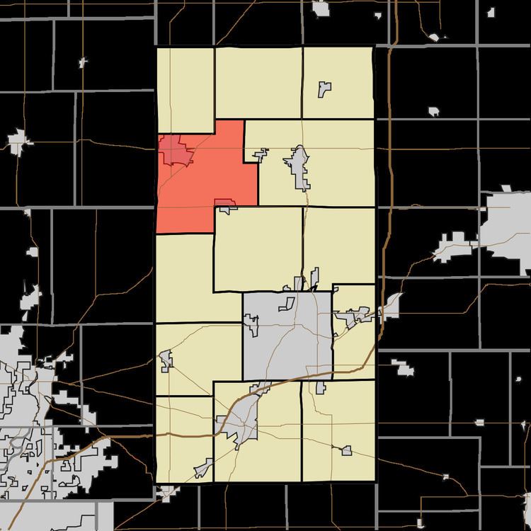
- Map of Pipe Creek Township IN USA
- History
- Geography
- Cities towns villages
- Unincorporated towns
- Cemeteries
- Major highways
- Airports and landing strips
- School districts
- Political districts
- References
Map of Pipe Creek Township, IN, USA
History
Pipe Creek Township was organized in 1833, and named after Pipe Creek.
Geography
According to the 2010 census, the township has a total area of 42.47 square miles (110.0 km2), of which 42.41 square miles (109.8 km2) (or 99.86%) is land and 0.06 square miles (0.16 km2) (or 0.14%) is water.
Cities, towns, villages
Unincorporated towns
Cemeteries
The township contains these nine cemeteries: Carr, Elwood, Howard, Prewett, Saint Josephs, Shell, Sigler, Stoken and Sunset Memorial Park.
Major highways
Airports and landing strips
School districts
Political districts
References
Pipe Creek Township, Madison County, Indiana Wikipedia(Text) CC BY-SA