
Basin area 148.2 km² | - elevation 3,285 ft (1,001 m) - elevation 1,289 ft (393 m) | |
 | ||
Similar Glady Fork, Burning Rock, South Branch Wildlife M, Teter Creek Lake Wildlife M, Castleman Run Lake Wildlife M | ||
Hatfield mccoy trails pinnacle creek
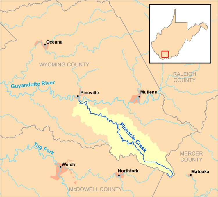
Pinnacle Creek is a tributary of the Guyandotte River, 26.6 miles (42.8 km) long, in southern West Virginia in the United States. Via the Guyandotte and Ohio rivers, it is part of the watershed of the Mississippi River, draining an area of 57.23 square miles (148.2 km2) in a rural area on the unglaciated portion of the Allegheny Plateau.
Contents
Map of Pinnacle Creek, Pineville, WV, USA
Pinnacle Creek's entire course and drainage area are in southern Wyoming County. It rises in the southeastern extremity of Wyoming County, near the common boundary of Wyoming, McDowell, and Mercer counties, approximately 2 miles (3.2 km) east of Crumpler, and flows generally northwestward to the south end of the town of Pineville, where it flows into the Guyandotte River from the south.
According to 1992 data from the United States Geological Survey, approximately 96% of the Pinnacle Creek watershed was forested; approximately 1% was used for agriculture; and approximately 2% was used for commercial or mining purposes.