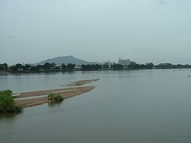
The Ping River (Thai: แม่น้ำปิง, rtgs: Maenam Ping, [mɛ̂ːnáːm piŋ]), along with the Nan River, is one of the two main tributaries of the Chao Phraya River. It originates at Doi Thuai in the Daen Lao Range, in Chiang Dao district, Chiang Mai Province. After passing Chiang Mai, it flows though the provinces of Lamphun, Tak, and Kamphaeng Phet. At the confluence with the Nan River at Nakhon Sawan (also named Paknam Pho in Thai), it forms the Chao Phraya River.
Map of Ping, Chiang Mai, Thailand
Khlung River (2)Suan Mak River (Joins the Ping at 16°29′42″N 99°29′56″E)Wang Chao River (Joins the Ping at 16°41′02″N 99°16′16″E)Pra Dang River (Joins the Ping at 16°44′46″N 99°13′05″E)Raka River (Placement in tributary tree is approximate, geographical coordinates unavailable due to poor satellite resolution)Wang River (Joins the Ping at 17°07′25″N 99°03′35″E in the town of Tak)Tributaries include Mo, Tui, Chang & Soi RiversTak River (Joins the Ping at 17°02′18″N 99°04′00″E)Ko River (Joins the Ping at 17°41′17″N 98°45′01″E)Tun River (Placement in tributary tree is approximate, geographical coordinates unavailable due to poor satellite resolution)Pa RiverChaem River (Joins the Ping at 18°11′19″N 98°38′02″E)Klang River (Joins the Ping at 18°22′12″N 98°40′55″E)Li River (Joins the Ping at 18°25′43″N 98°42′08″E)Tun River (2) (Placement in tributary tree is approximate, geographical coordinates unavailable due to poor satellite resolution)Khan River (2) (Joins the Ping at 18°30′05″N 98°51′04″E)Wang River (2) (Joins the Khan at 18°32′58″N 98°51′37″E)Kuang River (Joins the Ping at 18°32′33″N 98°56′07″E)Tha River (Joins Kuang at 18°32′23″N 98°56′29″E)Sapuat River (Placement in tributary tree is approximate, geographical coordinates unavailable due to inaccurate station data from Royal Irrigation Department)Khanat River (Placement in tributary tree is approximate, geographical coordinates unavailable due to poor satellite resolution)San River (Placement in tributary tree is approximate, geographical coordinates presently undeterminable due to recently built dam)Tip River (Placement in tributary tree is approximate, geographical coordinates presently undeterminable due to recently built dam)Phaem River (Placement in tributary tree is approximate, geographical coordinates unavailable due to poor satellite resolution)Mempin River (Placement in tributary tree is approximate, geographical coordinates unavailable due to poor satellite resolution)Lai River (2) (Placement in tributary tree is approximate, geographical coordinates unavailable due to poor satellite resolution)Sa River (Joins the Ping at 18°53′28″N 98°58′22″E)Rim River (Joins the Ping at 18°55′13″N 98°58′02″E)Nai River (Placement in tributary tree is approximate, geographical coordinates unavailable due to poor satellite resolution)Taeng River (Joins the Ping at 19°06′08″N 98°56′49″E)Ngat River (Joins the Ping at 19°09′11″N 99°00′44″E)The Ping Basin is one of the largest drainage basins of the Chao Phraya Watershed, draining 33,896 square kilometres (13,087 sq mi) of land.
The greater Ping Basin, i.e. the basin of the entire Ping river system including its tributary the Wang River, drains a total of 44,688 square kilometres (17,254 sq mi).
The main dams in the basin are the Bhumibol Dam and the Doi Tao Dam.
The Ping itself originates in Huai Nam Dang National Park and flows through Mae Ping National Park.