
- elevation 128 m (420 ft) - min 0 m/s (0 cu ft/s) Basin 10,794 km2 (4,168 sq mi) | - average 52 m/s (1,836 cu ft/s) Length 335 km | |
 | ||
- location West of Mae Salit, Ban Tak District, Tak Province - max 1,100 m/s (38,846 cu ft/s) | ||
The Wang River (Thai: แม่น้ำวัง, rtgs: Maenam Wang, [mɛ̂ːnáːm waŋ]) is a river in northern Thailand.
Contents
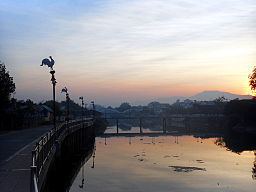
Map of Wang, Ban Tak District, Tak, Thailand
GeographyEdit
The Wang River is 335 kilometres (208 mi) long. Its waters flow from north to south. The Wang River has its source in the Phi Pan Nam Range in Wiang Pa Pao District, Chiang Rai Province. One of the principal settlements along the river is Lampang, which is on the north bank of a curve in the river. From Lampang, the river flows southwards passing by Thoen into Tak Province. It joins the Ping River near Mae Salit, Ban Tak District, north of the town of Tak. The Ping River is a tributary of the Chao Phraya River.
TributariesEdit
Tributaries of the Wang include the Mo, Tui, Chang, and Soi Rivers
Wang basinEdit
The Wang basin is part of the Greater Ping Basin and the Chao Phraya Watershed. The total land area drained by the Wang River and its tributaries is 10,792 square kilometres (4,167 sq mi).
Kiu Lom Dam (เขื่อนกิ่วลม) is on the Wang River about 38 kilometres (24 mi) from Lampang town.