
FIPS code 06-57260 Elevation 1,139 m Zip code 91962 Area code Area code 619 | Time zone PST (UTC-8) GNIS feature ID 1652774 Area 18.51 km² Population 1,510 (2010) | |
 | ||
Checkpoint campo border patrol station 8 june 2007 pine valley california 10 26
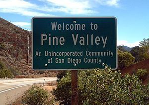
Pine Valley is a community and census-designated place (CDP) in the Cuyamaca Mountains of the Mountain Empire area, in southeastern San Diego County, California. The population was 1,510 at the 2010 census, up from 1,501 at the 2000 census.
Contents
- Checkpoint campo border patrol station 8 june 2007 pine valley california 10 26
- Map of Pine Valley CA 91962 USA
- Search and seizure at campo border patrol station police action in pine valley california
- Geography
- Climate
- 2010
- 2000
- Politics
- References
Map of Pine Valley, CA 91962, USA
Search and seizure at campo border patrol station police action in pine valley california
Geography
Pine Valley is named for the locally unique strand of Jeffrey pine (Pinus jeffreyi) found along Pine Valley Creek, a seasonal drainage in the foothills of the Laguna Mountains in central San Diego County. According to the United States Geological Survey, Pine Valley is located 3,736 feet (1,139 m) above sea level, at 32°49′17″N 116°31′45″W.
According to the United States Census Bureau Pine Valley is located at 32°49′41″N 116°31′36″W (32.828184, -116.526583), which is near the center of the Pine Valley census-designated place (CDP). The Pine Valley CDP has a total area of 7.1 square miles (18 km2), all land. Average annual precipitation is 23.7 inches (51.9 cm)
Climate
According to the Köppen Climate Classification system, Pine Valley has a warm-summer Mediterranean climate, abbreviated "Csb" on climate maps.
2010
The 2010 United States Census reported that Pine Valley had a population of 1,510. The population density was 211.3 people per square mile (81.6/km²). The racial makeup of Pine Valley was 1,408 (93.2%) White, 6 (0.4%) African American, 6 (0.4%) Native American, 16 (1.1%) Asian, 1 (0.1%) Pacific Islander, 20 (1.3%) from other races, and 53 (3.5%) from two or more races. Hispanic or Latino of any race were 154 persons (10.2%).
The Census reported that 1,510 people (100% of the population) lived in households, 0 (0%) lived in non-institutionalized group quarters, and 0 (0%) were institutionalized.
There were 610 households, out of which 162 (26.6%) had children under the age of 18 living in them, 367 (60.2%) were opposite-sex married couples living together, 43 (7.0%) had a female householder with no husband present, 30 (4.9%) had a male householder with no wife present. There were 137 (30.1%) unmarried opposite-sex partnerships, and 6 (1.0%) same-sex married couples or partnerships. 128 households (21.0%) were made up of individuals and 49 (8.0%) had someone living alone who was 65 years of age or older. The average household size was 2.48. There were 440 families (72.1% of all households); the average family size was 2.85.
The population was spread out with 279 people (18.5%) under the age of 18, 114 people (7.5%) aged 18 to 24, 284 people (18.8%) aged 25 to 44, 630 people (41.7%) aged 45 to 64, and 203 people (13.4%) who were 65 years of age or older. The median age was 48.3 years. For every 100 females there were 100.3 males. For every 100 females age 18 and over, there were 98.2 males.
There were 721 housing units at an average density of 100.9 per square mile (39.0/km²), of which 498 (81.6%) were owner-occupied, and 112 (18.4%) were occupied by renters. The homeowner vacancy rate was 1.4%; the rental vacancy rate was 5.9%. 1,217 people (80.6% of the population) lived in owner-occupied housing units and 293 people (19.4%) lived in rental housing units.
2000
As of the census of 2000, there were 1,501 people, 559 households, and 419 families residing in the CDP. The population density was 212.3 inhabitants per square mile (82.0/km²). There were 653 housing units at an average density of 92.4 per square mile (35.7/km²). The racial makeup of the CDP was 94.87% White, 0.67% Native American, 0.53% Asian, 2.27% from other races, and 1.67% from two or more races. Hispanic or Latino of any race were 7.13% of the population.
There were 559 households out of which 34.5% had children under the age of 18 living with them, 65.5% were married couples living together, 7.0% had a female householder with no husband present, and 24.9% were non-families. 19.3% of all households were made up of individuals and 6.3% had someone living alone who was 65 years of age or older. The average household size was 2.69 and the average family size was 3.11.
In the CDP, the population was spread out with 25.6% under the age of 18, 5.7% from 18 to 24, 23.3% from 25 to 44, 33.3% from 45 to 64, and 12.1% who were 65 years of age or older. The median age was 43 years. For every 100 females there were 93.2 males. For every 100 females age 18 and over, there were 91.8 males.
The median income for a household in the CDP was $64,265, and the median income for a family was $71,949. Males had a median income of $51,940 versus $34,583 for females. The per capita income for the CDP was $24,945. About 4.7% of families and 3.9% of the population were below the poverty line, including 4.2% of those under age 18 and 6.9% of those age 65 or over.
Politics
In the state legislature Pine Valley is located in the 36th Senate District, represented by Republican Joel Anderson, and in the 66th Assembly District, represented by Republican Kevin Jeffries.
In the United States House of Representatives, Pine Valley is in California's 50th congressional district, represented by Republican Duncan D. Hunter.