
Elevation 1,985 m Country United States of America | ||
 | ||
Mountains Cuyamaca Peak, El Cajon Mountain, Whale Mountain, Chiquito Peak Similar Cuyamaca Peak, San Diego River, Stonewall Peak, Volcan Mountains, Volcan Mountain Wilderne | ||
The Cuyamaca Mountains, locally the Cuyamacas, are a mountain range of the Peninsular Ranges System, in San Diego County, southern California. The mountain range runs roughly northwest to southeast. The Laguna Mountains are to the east.
Contents
Map of Cuyamaca Mountains, California 91916, USA
GeographyEdit
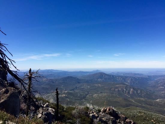
The range's highest peaks are Cuyamaca Peak at 6,512 feet (1,985 m), and Stonewall Peak at 5,700 feet (1,700 m). The San Diego River and the Sweetwater River both have headwaters in the Cuyamacas. The Cuyamaca Reservoir lies adjacent to the east side of the range.
Mountains are primarily protected within the Cleveland National Forest. Cuyamaca Rancho State Park, with California oak woodlands habitat, is located in the range.
The former mining town of Julian is in the northern section, and the towns of Descanso, Pine Valley and Guatay is in the southern.
Interstate 8 passes through the southern part of the Cuyamaca Mountains. California State Route 79, known as the Cuyamaca Highway, runs north–south along the eastern part of the mountains.
Gold rushEdit
Gold was discovered in the Cuyamacas in 1870 and the mountains were subject to a gold rush. Towns and encampments of Coleman City, Branson City, Eastwood, Julian, and Banner sprang up to support the miners. First a mining camp called Stonewall (1873–1876), then the company town of Stratton (1887–1888), renamed Cuyamaca City (1888–1906), had a peak population of 500 and served the Stonewall Mine. The town was abandoned after mining operations ceased, and few traces of it exist. The site of the town now lies within Cuyamaca Rancho State Park. Other gold mines were supported by the town of Julian, which celebrates its mining history with an annual festival called Gold Rush Days. The Eagle-High Peak Mine, no longer productive, is now a museum and gives daily tours.
AttractionsEdit
Various types of things to do while in the Cuyamaca Mountains include family activities, alone time, or a little of both. The Cuyamaca lake provides family with safe, affordable camping grounds. This includes places to pitch a tent, or even spots to park your motorhome vehicle. If you own a boat many people will go out on the water and fish the various game the lake holds. Of course you can also hike or bike the Cuyamaca Mountains. These trails will bring you face to face with the local wildlife and give you the full out door experience. The trails inside beginner, intermediate, or more advanced the extreme outdoor enthusiast. Just to the North you can find the town of Julain. Julian is great for families to walk around and explore the beautiful town and what it has to offer.