
Type Reservoir Max. length 29.6 km (18.4 mi) Surface elevation 261 m Length 29.6 km | Primary inflows Surface area 5,970 acres (2,420 ha) Area 24.16 km² Catchment area 4,002 km² Outflow location Kings River | |
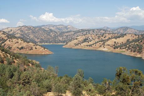 | ||
Campgroundviews com island park recreation area piedra california ca pine flat lake
Pine Flat Lake is an artificial lake in the Sierra Nevada foothills of eastern Fresno County, California and provides the western north-south border to the Sierra- and Sequoia National Forests, about 30 mi (48 km) east of Fresno.
Contents
- Campgroundviews com island park recreation area piedra california ca pine flat lake
- Map of Pine Flat Lake California 93657 USA
- References
Map of Pine Flat Lake, California 93657, USA
The lake was formed by the construction of Pine Flat Dam on the Kings River in 1954 by the United States Army Corps of Engineers, and has a storage capacity of 1,000,000 acre·ft (1.2 km3). Although primarily designed for flood control, the project also provides for irrigation and groundwater recharge, recreation, and with the completion in 1984 of the Jeff L. Taylor Pine Flat Power Plant, generation of 165 MW hydroelectric power.
Infrastructure security measures taken at the dam are greater than at most California dams, and the parapet wall cannot be approached from any direction. A large area in front of the dam that was previously accessible has been closed off, as have some roads and trails.