
Governing body U.S. Forest Service Established 1908 | Area 4,829 km² | |
 | ||
Location Tulare / Kern / Fresno counties, California, US Nearest city Bakersfield, CA / Porterville, CA / Management United States Forest Service Porterville Porterville, CA, United States Phone +1 760-379-5646 Management U.S. Department of Agriculture Forest Service Similar Sequoia National Park, Sequoia and Kings Canyon National Parks, General Sherman (tree) | ||
Sequoia national forest national park in california
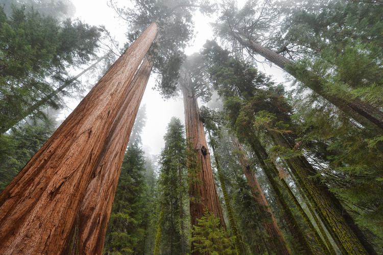
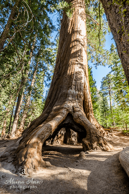
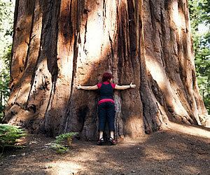
Sequoia National Forest is located in the southern Sierra Nevada mountains of California. The U.S. National Forest is named for the majestic Giant Sequoia (Sequoiadendron giganteum) trees which populate 38 distinct groves within the boundaries of the forest.
Contents
- Sequoia national forest national park in california
- Geography
- The Needles
- Wilderness areas
- Recreation
- History
- Giant sequoia groves
- Giant Sequoia National Monument
- Marijuana
- References
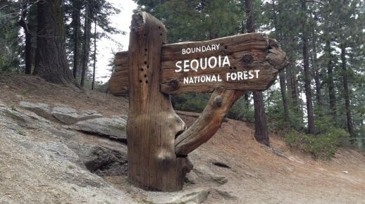
The Giant Sequoia National Monument is located in the national forest. Other notable features include glacier-carved landscapes and impressive granite monoliths. The Needles are a series of granite spires atop a narrow ridge above the Kern River. Forest headquarters are located in Porterville, California. There are local ranger district offices in Dunlap, Kernville, Lake Isabella, and Springville.
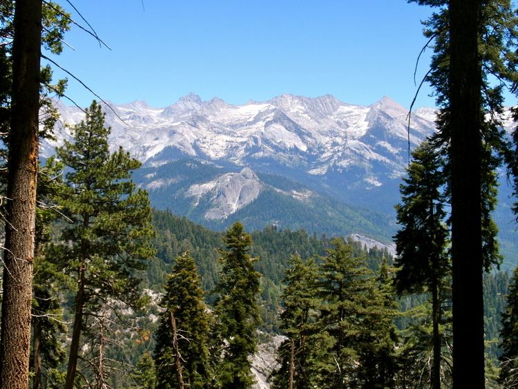
Geography
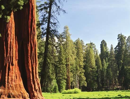
The Sequoia National Forest covers 1,193,315 acres (1,864.555 sq mi; 4,829.17 km2), and ranges in elevation from 1,000 feet (300 m) in the foothills of the Sierra Nevada to over 12,000 feet (3,700 m). Its Giant Sequoia (Sequoiadendron giganteum) groves are part of its 196,000 acres (790 km2) of old growth forests. Other tree species include:
The Needles
The Needles are a series of granite spires atop a narrow ridge above the Kern River.(36.1214°N 118.5044°W / 36.1214; -118.5044)
Wilderness areas
There are six wilderness areas within Sequoia NF that are part of the National Wilderness Preservation System. Some of these extend into neighboring National Forests, as indicated. Two of them also extend into land that is managed by the Bureau of Land Management.
Recreation
The National Forest contains over 2,500 miles (4,000 km) of road and 850 miles (1,370 km) of trails, and hosts a number of camping and recreational facilities. The forest is adjacent to Sequoia and Kings Canyon National Parks.
History
Sequoia National Forest was established on July 1, 1908 from a portion of Sierra Forest Reserve. On March 2, 1909 Theodore Roosevelt added land by Presidential Proclamation. On July 1, 1910 1,951,191 acres (7,896.19 km2) was removed from the forest to create the Kern National Forest. This land was returned to Sequoia National Forest on July 1, 1915.
Giant sequoia groves
The Sequoia National Forest has 34 giant sequoia groves.
- Indian Basin Grove (GSNM) A mid-size grove, mostly logged. It can be accessed by paved roads. The grove contains many young sequoias approaching diameters of up to 10 feet (3.0 m). 36°48′N 118°56′W 1800–2000 m.
- Converse Basin Grove (GSNM). Once the second-largest grove, but much logged around 1890-1900; However, nearly 100 widely scattered old-growth Giant Sequoias remain (apparently bypassed by the loggers), also good regrowth of younger trees. Home of the Boole Tree, which the loggers spared as it was by far the largest tree in the grove and is now identified as the sixth-largest tree by volume. Also home of the Chicago Stump, which is the remnant of the General Noble Tree that was cut for the 1893 World Columbian Exposition; the General Noble Tree was the second largest tree in the grove (after the Boole Tree) and it was the largest tree ever cut down. Although not among the very largest Giant Sequoias, the General Noble Tree was perhaps among the top 30 largest Giant Sequoias before it was cut. 36°48′N 118°58′W 1800–2000 m.
- Lockwood Grove (GSNM). 36°48′N 118°52′W 1700–1800 m.
- Monarch Grove (GSNM). Immediately north of the Agnew Grove, near Monarch Wilderness boundary. On Forest Service GSNM map.
- Evans Grove (GSNM). Partially logged, before 1920. 36°48'N 118°49'30"W 2050–2250 m.
- Agnew & Deer Meadow Grove (GSNM). 36°47′20″N 118°46′45″W 1950–2000 m.
- Cherry Gap Grove (GSNM). Logged. Located between Converse Basin Grove and General Grant Grove, near McGee Overlook (36°46′40″N 118°57′30″W). 2070 m. Cherry Gap Grove is a small sequoia grove of about thirty-five acres in Sequoia national forest; it was logged of all of its old growth sequoias.
- Abbott Creek Grove (GSNM). 36°46′N 118°58′W 1900 m. Listed by Rundel and Flint; very small (largely logged); too few trees to qualify as a grove according to Willard.
- Kennedy Grove (GSNM). 36°46′0″N 118°49′20″W 2050–2250 m. Contains the 13th largest giant sequoia in the world, The Ishi Giant.
- Little Boulder Creek Grove (GSNM). 36°45′10″N 118°49′0″W 2000 m.
- Boulder Creek Grove (GSNM). 36°45′N 118°49′W 2050 m.
- Landslide Grove (GSNM). 36°45′0″N 118°51′50″W 2050–2250 m.
- Bearskin Grove (GSNM). 36°45′0″N 118°54′40″W 1850–1900 m.
- Big Stump Grove (KCNP/GSNM). 36°43′N 118°58′W 1850 m.
- Redwood Mountain Grove (KCNP/GSNM). The largest grove, 1240 ha (3100 acres), with 15,800 sequoias 30 cm (one foot) or more in diameter at the base.
- Upper Tule Grove (GSNM). Included on Forest Service GSNM map.
- Maggie Mountain Grove (GSNM).
- Silver Creek Grove (GSNM).
- Mountain Home Grove (CSF / GSNM). Home of the 'Genesis' tree, seventh largest by volume, this grove also contains the smaller Middle Tule Grove
- Burro Creek Grove (GSNM).
- Wishon Grove (GSNM). South of Silver Creek Grove. Included on Forest Service GSNM map.
- Alder Creek Grove (GSNM / private); also known as Hossack, Pixley, or Ross Creek Grove. Home of 'Alonzo Stagg', the fifth largest tree by volume. Also home to the Waterfall tree, which has the largest circumference and diameter at ground level of any sequoia.
- McIntyre Grove (GSNM).
- Carr Wilson Grove(GSNM); also known as Bear Creek Grove.
- Freeman Creek Grove (GSNM).
- Black Mountain Grove (GSNM / TIR / private). Heavily logged in 1984, though mature sequoias were not cut.
- Red Hill Grove (GSNM / private).
- Peyrone Grove (GSNM / TIR).
- South Peyrone Grove (GSNM) New discovery by Willard in 1992.
- Long Meadow Grove (GSNM), Site of the Trail of 100 Giants and one tree of great size.
- Cunningham Grove (GSNM).
- Starvation Creek Grove (GSNM).
- Packsaddle Grove (GSNM).
- Deer Creek Grove (GSNM). The southernmost grove.
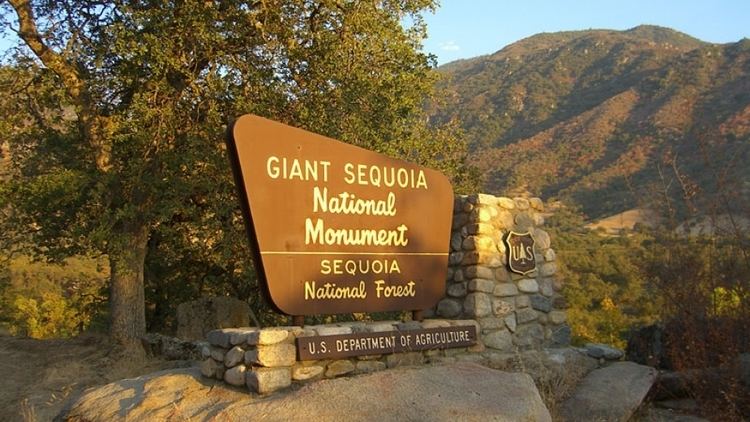
Giant Sequoia National Monument
On April 15, 2000 President Bill Clinton proclaimed 328,000-acre (1,330 km2) of the Sequoia National Forest as the Giant Sequoia National Monument by Presidential Proclamation 7295, published in the Federal Register, Tuesday, April 25, 2000, Vol. 65, No. 80.
The monument is in two sections. The northern section surrounds General Grant Grove and other parts of Kings Canyon National Park and is administered by the Hume Lake Ranger District. The southern section is directly south of Sequoia National Park and is administered by the Western Divide Ranger District, surrounding the eastern half of the Tule River Indian Reservation.
Marijuana
The forest has been the scene of extensive illegal marijuana cultivation, with recent involvement of Mexican drug cartels.