
Population 50 (2006 census) Time zone ACST (UTC+9:30) Postal code 5720 | Postcode(s) 5720 Mean max temp Mean min temp Local time Monday 10:53 AM | |
 | ||
Weather 31°C, Wind NE at 16 km/h, 29% Humidity | ||
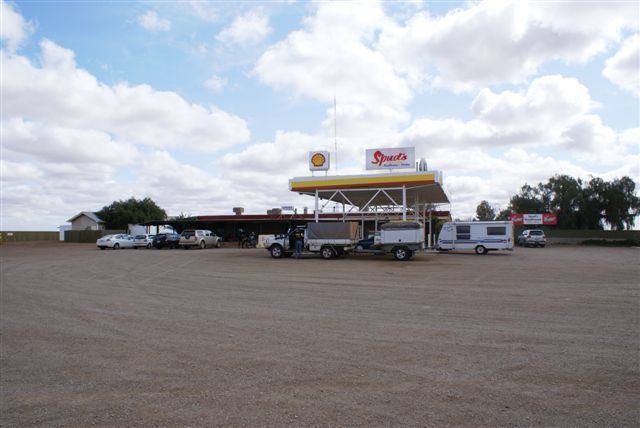
Pimba is a small settlement lying on the transcontinental railway line in the Australian state of South Australia. It lies at the junction of the Stuart Highway to Alice Springs and the road to Woomera, Roxby Downs and Andamooka . It is 480 km from Adelaide. There is an iconic roadhouse, named "Spud's Roadhouse", which sells fuel and general shop items and meals and has accommodation. At the 2006 census, Pimba had a population of 50.
Map of Pimba SA 5720, Australia
Pimba was originally established as a construction camp for the transcontinental railway in the early 20th century and was retained as a railway siding. It is reported as being surveyed as a township during the 1960s and was gazetted as a locality in August 2004 under the Geographical Names Act 1991 with creation of boundaries along with the retention of the “long established name.”
Despite the small population, the Indian Pacific (running between Sydney and Perth) and Ghan (running between Adelaide, Alice Springs and Darwin, trains still call at Pimba Siding on request; both trains service the town twice a week in each direction.
Pimba is located within the federal division of Grey, the state electoral district of Giles and the unincorporated area of South Australia. As of 2016, the community within Pimba received municipal services from a South Australian agency, the Outback Communities Authority.