
ZIP codes 65233, 65276, 65322 Elevation 248 m Local time Sunday 6:25 PM | Time zone CST (UTC-6) GNIS feature ID 0766536 Area 93.7 km² Population 1,134 (2000) | |
 | ||
Weather 19°C, Wind SE at 26 km/h, 49% Humidity | ||
Pilot Grove Township is one of fourteen townships in Cooper County, Missouri, USA. As of the 2000 census, its population was 1,134.
Contents
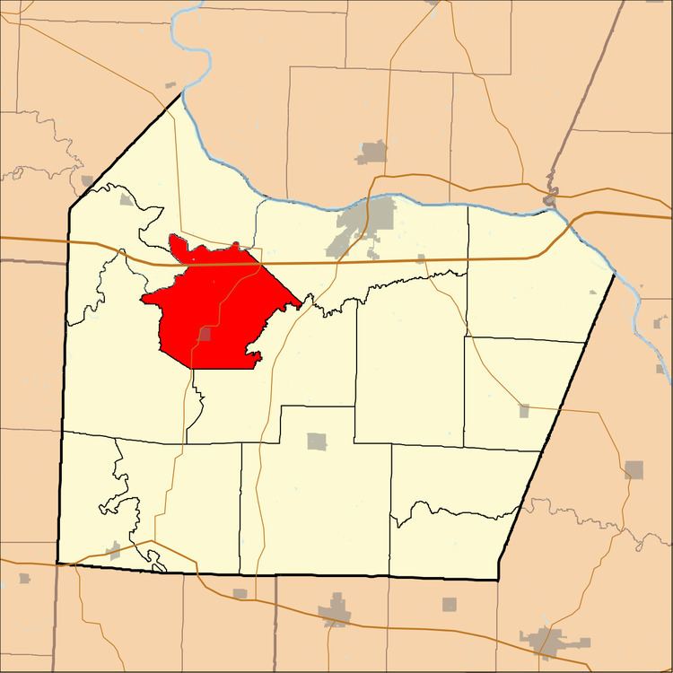
- Map of Pilot Grove Township MO USA
- Geography
- Cities towns villages
- Unincorporated towns
- Adjacent townships
- Cemeteries
- Major highways
- School districts
- Political districts
- References
Map of Pilot Grove Township, MO, USA
Geography
According to the United States Census Bureau, Pilot Grove Township covers an area of 36.18 square miles (93.7 square kilometers); of this, 35.94 square miles (93.09 square kilometers, 99.35 percent) is land and 0.24 square miles (0.61 square kilometers, 0.65 percent) is water.
Cities, towns, villages
Unincorporated towns
(This list is based on USGS data and may include former settlements.)
Adjacent townships
Cemeteries
The township contains these four cemeteries: Mount Vernon, Pleasant Hill, Saint Joseph and Saint Martin.
Major highways
School districts
Political districts
References
Pilot Grove Township, Cooper County, Missouri Wikipedia(Text) CC BY-SA