
Easiest route from col d'Izoard Prominence 1,019 m | Elevation 3,320 m | |
 | ||
Listing Alpine mountains above 3000 m Similar Pics de la Font Sancte, Mont Chaberton, Punta Ramiere, Pain de Sucre, Massif du Queyras | ||
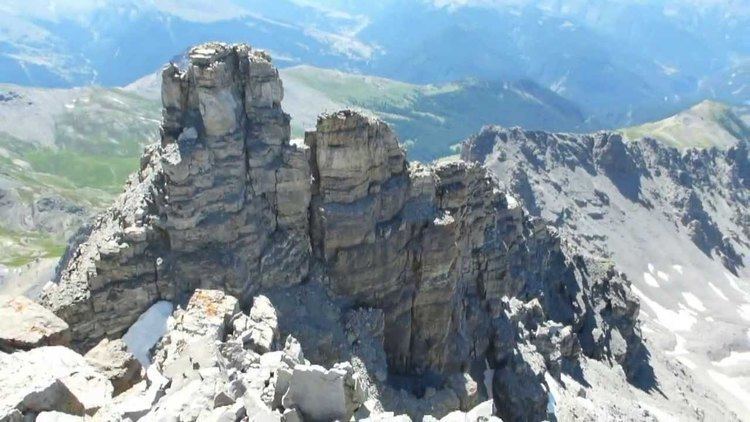
The Pic de Rochebrune (or Grand Rochebrune or, simply, Rochebrune) is a mountain in the Cottian Alps belonging to the French department of Hautes-Alpes.
Contents
- Map of Pic de Rochebrune 05100 CerviC3A8res France
- EtymologyEdit
- GeographyEdit
- Nature conservationEdit
- Access to the summitEdit
- MapsEdit
- References
Map of Pic de Rochebrune, 05100 Cervi%C3%A8res, France
EtymologyEdit
The literal English translation of Pic de Rochebrune can be dark rock peak or brown rock peak.
GeographyEdit
The mountain is the highest summit of the Central Cottian Alps.
Nature conservationEdit
The Pic de Rochebrune is located on the northern border of the regional nature park of Queyras (Parc naturel régional du Queyras ), established in 1977.
Access to the summitEdit
The easiest route to reach the summit starts from the Izoard pass. It requires some climbing skills.
MapsEdit
References
Pic de Rochebrune Wikipedia(Text) CC BY-SA