
Time zone CET (UTC+1) Area 43 km² Population 729 (1999) | INSEE/Postal code 2A215 /20131 Local time Friday 9:27 AM | |
 | ||
Weather 12°C, Wind NW at 0 km/h, 88% Humidity | ||
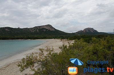
Pianottoli-Caldarello (Corsican: Pianottuli Caldareddu, also spelled Pianotolli-Caldarello) is a commune in the Corse-du-Sud department of France on the island of Corsica.
Contents
Map of Pianottoli-Caldarello, France
It shares the canton of Figari with the commune of Figari, Sotta and Monacia-d'Aullène.
Geography
Pianottoli-Caldarello is 9 kilometres (6 mi) to the west of the commune of Figari on the road to Sartène. Originally named Caldarello, it was detached from Zérubia in 1864 then changed its name in 1921. The commune comprises predominantly shoreline with the Bay of Figari to the east, Point Capineru, the small islands of Bruzzi (a nature reserve) and two deep coves (Chevanu and Arbitru). A small port is developing near Caldarello to the east. The rocky hinterland extends in the direction of Mount Cagna to the north, going up to 1,340 metres (4,400 ft) on Ovace; for a long tome it served as pasturage for Zérubia, and is still used for that purpose.