Area 350,000 km² | Country USA | |
 | ||
Thickness Up to 420 metres (1,380 ft) Named by Richards and Mansfield, 1912 | ||
The Phosphoria Formation of the western United States is a geological formation of Early Permian age. It represents some 15 million years of sedimentation, reaches a thickness of 420 metres (1,380 ft) and covers an area of 350,000 square kilometres (140,000 sq mi).
Contents
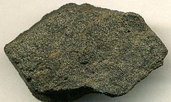
The formation includes phosphorite beds that are an important source of phosphorus. They have been mined in southeastern Idaho, northern Utah, western Wyoming, and southwestern Montana. Low concentrations of uranium are present in the phosphorite beds, and a vanadium-enriched zone is present in western Wyoming and southeastern Idaho. Many of the Phosphoria shales are rich in organic matter and are petroleum source rocks, and petroleum has been produced from some of the dolostones in the formation.
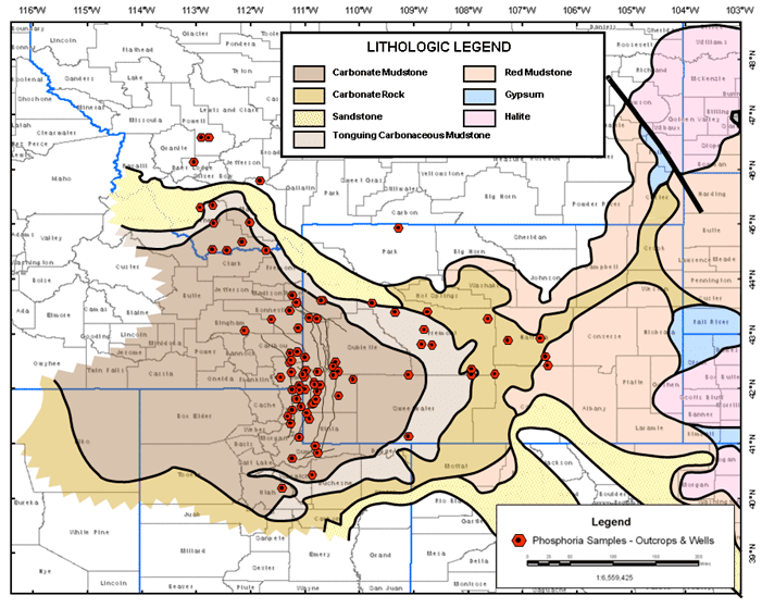
Stratigraphy and Lithology
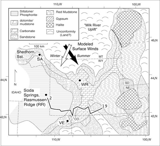
The Phosphoria Formation was deposited under marine conditions in a foreland basin located between the Paleozoic continental margin and the North American cratonic shelf.
The formation is commonly subdivided, from the top downward, as follows:
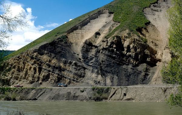
The Phosphoria is underlain by the Pennsylvanian-Permian Casper Formation or, depending on the location, by the Park City Formation or the Tensleep Sandstone, and it is overlain by the Triassic Dinwoody Formation. The upper boundary is placed at the top of the uppermost phosphorite bed and below the tan calcareous siltstone of Dinwoody formation. The lower boundary is marked by a thin phosphorite that contains abundant fish scales and bones.
Thickness and Distribution
The formation reaches its greatest thickness in the Sublett Range in the Paleozoic cordilleran structural basin of southern Idaho. Within the basin the formation consists of a basal phosphorite overlain by a thick sequence of chert and cherty sandstone. To the east in western Wyoming the Phosphoria gradually decreases in thickness and is intertongued with carbonate rocks of the Park City Formation and redbed sandstones of the Chugwater Formation of Permian to Triassic age. The Phosphoria units extend into the Wind River Mountains and pinch out in the Green Mountains to the east.
Paleontology
Fossils recovered from the Phosphoria Formation include brachiopods, sponge spicules, crinoid stems, conodont elements, and fish scales and bones. The Early Permian age of the formation is based primarily on conodont biostratigraphy.