
Existed: 1928 – present Length 29 km | Counties: Bucks Constructed 1928 | |
 | ||
County | ||
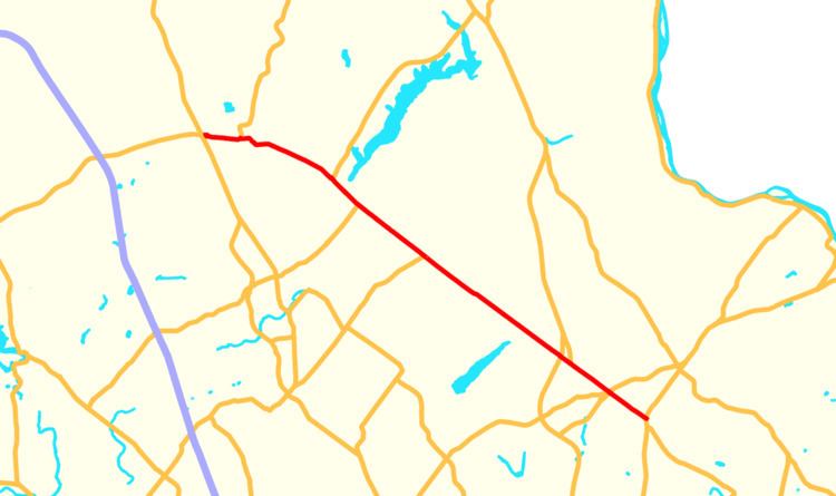
Pennsylvania Route 313 (PA 313) is a mostly 2-lane, 18-mile-long (29 km) state highway entirely within Bucks County, Pennsylvania. The western end of PA 313 is at an intersection with PA 309 and PA 663 in Quakertown. The easstern end is at an intersection with PA 263 in the Doylestown Township community of Furlong. PA 313 is signed an east–west road, although it runs almost purely northwest–southeast through most of its course. It is a major arterial road in central and northern Bucks County as it connects several communities including Quakertown, Dublin, and Doylestown.
Contents
- Map of PA 313 Pennsylvania USA
- Route description
- History
- Major intersections
- PA 313 Truck
- PA 313 Alternate Truck
- References
Map of PA-313, Pennsylvania, USA
The predecessors to present-day PA 313 were the Swamp Road, constructed in 1737, and the Dublin Pike, built in 1876. The route between Kulps Corner and Doylestown was originally designated as part of PA 113 by 1927, with a portion in Quakertown designated as PA 212 by the same time. PA 313 was designated by 1930 to run from U.S. Route 309 (US 309) and PA 312 in Quakertown southeast to PA 113 and PA 413 in Kulps Corner. The roadway was finished during the 1930s. PA 313 was extended southeast to US 202 in Buckingham by 1947, replacing a part of PA 113. The route was moved to its current eastern terminus by 1980.
Route description
PA 313 begins at an intersection with PA 309 and the northern terminus of PA 663 in the borough of Quakertown in Bucks County. Past the western terminus, the roadway continues as PA 663. From this intersection, PA 313 heads east on two-lane undivided West Broad Street, passing a mix of homes and businesses before heading into residential areas past the Main Street intersection. The route heads into the commercial downtown of Quakertown, where it splits into a one-way pair with two lanes in each direction. PA 313 becomes a two-way, two-lane road again and crosses an East Penn Railroad line, becoming East Broad Street and coming to an intersection with the western terminus of PA 212. Following this intersection, the road passes homes, turning to the southeast. PA 313 continues near more residences with some businesses, making a turn to the east and leaving Quakertown for Richland Township. Here, the route becomes Doylestown Pike and heads southeast through areas of fields and woods with some homes. The road heads into more forested areas and enters East Rockhill Township at the Rockhill Road intersection, where the name changes to Dublin Pike. PA 313 comes to an intersection with PA 563, which heads northeast to Nockamixon State Park, at which point PA 563 joins PA 313 in a concurrency. The road passes to the southwest of the state park and continues through a mix of farm fields and woods with occasional residences. PA 563 splits from PA 313 by heading southwest on Ridge Road.
Past this intersection, PA 313 continues southeast, passing through more rural areas. At the Old Bethlehem Road intersection, the route becomes the border between Bedminster Township to the northeast and Hilltown Township to the southwest, running through agricultural areas with some woods and homes. The road crosses PA 113 in Kulps Corner, at which point there are a few businesses. PA 313 heads into the borough of Dublin at the Rickert Road intersection and becomes Main Street, where it passes homes and businesses. The route runs past more residences before it leaves Dublin and becomes the border between Bedminster Township and Hilltown Township again, with the name changing back to Dublin Pike. The road heads into rural areas with some development and becomes the border between Plumstead Township to the northeast and Hilltown Township to the southwest at the Applebutter Road intersection, at which point the name changes to Swamp Road. At the intersection with Stump Road/Upper Stump Road, PA 313 becomes the line between Plumstead Township to the northeast and New Britain Township to the southwest, continuing through farmland with some woods and homes. The route passes to the northeast of Peace Valley Park before it comes to an intersection with Ferry Road in the community of Fountainville.
At this point, the road becomes the border between Plumstead Township to the northeast and Doylestown Township to the southwest, heading past residential subdivisions. PA 313 heads into commercial areas and widens into a four-lane divided highway as it comes to a partial interchange with the PA 611 freeway bypass of the borough of Doylestown, with access to southbound PA 611 and from northbound PA 611. The route passes more businesses as a five-lane road with a center left-turn lane, becoming the border between Buckingham Township to the northeast and Doylestown Township to the southwest before crossing Easton Road/Main Street. Past the Old Easton Road intersection a short distance later, the road becomes two lanes and runs along the line between Buckingham Township to the northeast and Doylestown to the southwest, passing homes and businesses before running between farm fields to the northeast and Fonthill County Park to the southwest, which contains the Fonthill Museum and the Moravian Pottery and Tile Works. PA 313 fully enters Doylestown at the Court Street intersection and passes through residential areas. The route becomes the border between Buckingham Township and Doylestown again as it runs near more homes and reaches an intersection with US 202. Following this intersection, PA 313 runs along the border between Buckingham Township to the northeast and Doylestown Township to the southwest, passing through a mix of woods and residential subdivisions before it reaches its eastern terminus at an intersection with PA 263 in the community of Furlong. Past this intersection, Swamp Road continues southeast as an unnumbered road toward the borough of Newtown.
History
Swamp Road dates back to 1737, when the Newtown Road was constructed and connected Newtown with Quakertown and Milford Township. The Dublin Pike was constructed in 1876. When Pennsylvania first legislated routes in 1911, what is now PA 313 from northwest of Dublin to Doylestown was legislated as part of Legislative Route 154. By 1927, PA 212 was designated on the westernmost part of current PA 313 and PA 113 was designated along the part of present-day PA 313 between Kulps Corner and Doylestown. PA 313 was designated by 1930 to run from US 309 (now PA 309) and PA 312 (now PA 663) in Quakertown southeast to PA 113 and PA 413 in Kulps Corner. At this time, the route southeast of Quakertown was under construction. The portion of PA 313 between Quakertown and Kulps Corner was completed during the 1930s. PA 313 was extended southeast to US 202, PA 263, and PA 413 in Buckingham by 1947, replacing PA 113 between Kulps Corner and Doylestown, passing to the north of Doylestown, and replacing PA 113 along a concurrency with US 202 between Doylestown and Buckingham. By 1980, PA 313 was rerouted to end at its present location at PA 263.
Major intersections
The entire route is in Bucks County.
PA 313 Truck
Pennsylvania Route 313 Truck signs are posted to direct trucks from westbound PA 212 to PA 313 in Quakertown, Pennsylvania, avoiding the intersection between PA 212 and PA 313. From PA 212, the route runs west on Mill Street and south on 4th Street to PA 313.
PA 313 Alternate Truck
Pennsylvania Route 313 Alternate Truck was a truck route around a weight-restricted bridge over Beaver Run in Quakertown, on which trucks over 36 tons and combination loads over 40 tons were prohibited. The route followed PA 309, Lawn Avenue, and PA 563. It was signed in 2013, but the bridge was repaired, thus decommissioning PA 313 Alt. Truck in 2015.