Time zone IST (UTC+5:30) Area 3,860 km² | Vehicle registration UK 04 Population 955,128 (2011) | |
 | ||
Colleges and Universities Kumaun University, Uttarakhand Open University, Government Medical College, Haldwani Points of interest Nainital Lake, Jim Corbett National Park, Pt GB Pant High Altitude Z, Sattal, Bhimtal Lake Destinations Nainital, Jim Corbett National, Mukteshwar, Bhimtal, Haldwani | ||
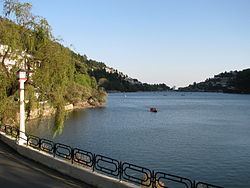
Nainital district is a district of Uttarakhand state, India. The headquarters is at Nainital.
Contents
Map of Nainital, Uttarakhand
Nainital District is located in Kumaon Division, and is bounded on the north by the Almora District and on the south by the Udham Singh Nagar District. Haldwani is the largest town in the district.
Demographics
According to the 2011 census Nainital district has a population of 955,128. This gives it a ranking of 457th in India (out of a total of 640). The district has a population density of 225 inhabitants per square kilometre (580/sq mi) . Its population growth rate over the decade 2001-2011 was 25.2%. Nainital has a sex ratio of 933 females for every 1000 males, and a literacy rate of 84.85%.
As of 2001 Indian census, the Nainital district had a population of 762,909, including 655,290 Hindus, 86,532 Muslims, and 16,107 Sikhs.
Assembly Constituencies
- Lalkua
- Bhimtal
- Nainital (SC)
- Haldwani
- Kaladhungi
- Ramnagar
