
- elevation 1,232 ft (376 m) - summer (DST) EDT (UTC-4) Local time Friday 3:12 PM | - elevation 430 ft (131 m) Zip code 12563 Area code 278 | |
 | ||
Weather 4°C, Wind S at 13 km/h, 60% Humidity Area 85.21 km² (83.66 km² Land / 155 ha Water) | ||
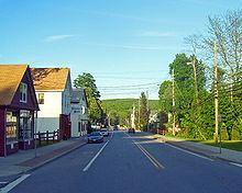
Patterson is a town in Putnam County, New York, United States. The town is in the northeast part of the county. Interstate 84 passes through the southwest part of the town. The population was 12,023 at the 2010 census. The town is named after early farmer Matthew Paterson. The reason Patterson was spelled with two "t"s was due to the looseness with which Paterson spelled his own last name.
Contents
- Map of Patterson NY 12563 USA
- History
- Notable people
- Geography
- Demographics
- Transportation
- Government
- Communities and locations in Patterson
- References
Map of Patterson, NY 12563, USA
History
The town was first settled around 1720 in The Oblong, which was a disputed area in southeastern New York also claimed by the colony of Connecticut. The Oblong was a strip of land approximately 2.9 km wide between Dutchess County New York and Connecticut, ceded to New York in the 1731 Treaty of Dover. Between 1720 and 1776 a large number of mostly Connecticut families settled in the southern Oblong who could not settle west of it because that land was privately owned by the Philipse Family, who owned virtually all of the rest of the future Putnam County. The first such settlers were the Hayt family, who built a house at The Elm in 1720. Another early settler was Jacob Haviland, who settled Haviland Hollow in 1731. The first village in Putnam County, the hamlet of Patterson, was originally called Frederickstown, which lent its name to the eastern part of the future Putnam County other than the oblong, which was called Southeast Precinct (not the same as the current town of Southeast).
After the revolution, the Philipse land was confiscated, and in 1788, the former Philipse portion of the Oblong was chartered as the Town of Southeast, the remainder of the region being chartered as the Town of Fredericktown. In 1795, Fredericktown township was split up into four parts: 1. the Town of Carmel, 2. a part which was combined with the northern half of Southeast and became the Town of Franklin which was renamed the Town of Patterson in 1808, 3. a part which was combined with the southern half of Southeast and became the new, much larger town of Southeast, and 4. the remnant of the town, which was the Town of Frederick for a while, but was renamed the Town of Kent in 1817.
Notable people
Geography
According to the United States Census Bureau, the town has a total area of 32.9 square miles (85 km2), of which, 32.3 square miles (84 km2) of it is land and 0.6 square miles (1.6 km2) of it (1.95%) is water.
The north town line is the border of Dutchess County, New York, and the east town line is the border of Connecticut.
Demographics
As of the census of 2000, there were 11,306 people, 3,529 households, and 2,678 families residing in the town. The population density was 350.4 people per square mile (135.3/km²). There were 3,746 housing units at an average density of 116.1 per square mile (44.8/km²). The racial makeup of the town was 91.28% White, 3.56% African American, 0.16% Native American, 1.27% Asian, 0.03% Pacific Islander, 1.95% from other races, and 1.76% from two or more races. Hispanic or Latino of any race were 7.01% of the population.
There were 3,529 households out of which 41.3% had children under the age of 18 living with them, 63.0% were married couples living together, 9.6% had a female householder with no husband present, and 24.1% were non-families. 18.6% of all households were made up of individuals and 5.2% had someone living alone who was 65 years of age or older. The average household size was 2.86 and the average family size was 3.29.
In the town, the population was spread out with 26.7% under the age of 18, 7.0% from 18 to 24, 36.8% from 25 to 44, 22.9% from 45 to 64, and 6.7% who were 65 years of age or older. The median age was 36 years. For every 100 females there were 106.0 males. For every 100 females age 18 and over, there were 104.5 males.
The median income for a household in the town was $66,250, and the median income for a family was $75,746. Males had a median income of $50,161 versus $37,975 for females. The per capita income for the town was $26,103. About 3.7% of families and 4.9% of the population were below the poverty line, including 6.0% of those under age 18 and 11.2% of those age 65 or over.
Transportation
Two main thoroughfares run through Patterson, NY State Route 22 & State Route 311. State Route 22 runs through every town on the East side of Putnam County, and runs directly through the Business District of Patterson. I-84 passes in the southwest and houses Exit 18 for Route 311. Metro-North Railroad has rail commuter rail service to New York City via the Harlem Line, with the Patterson train station in the town center.
Government
Patterson is governed by a town board. The town hall is located on New York State Route 311 in Patterson. Law enforcement services for Patterson are provided by the New York State Police and the Putnam County Sheriff's Department.