
Time zone Eastern (EST) (UTC-5) Zip code 10509 | State New York Elevation 338 ft (103 m) Area code(s) 845 Population 18,404 (2010) | |
 | ||
Weather 6°C, Wind E at 5 km/h, 93% Humidity Points of interest East Branch Reservoir, Bog Brook Reservoir, Middle Branch Reservoir, Titicus Reservoir, Wells Park | ||
Southeast is a town in Putnam County, New York, United States. The population was 18,404 at the 2010 census. The town is in the southeast part of the county. Interstate 84, Interstate 684, U.S. Route 202, and US Route 6 pass through the town.
Contents
- Map of Southeast NY USA
- History
- Post offices
- Geography
- Demographics
- Government
- Communities and locations in Southeast
- Political leaders
- Notable residents of Southeast
- References
Map of Southeast, NY, USA
History
The first settler arrived around 1730. The area first exploited was called "The Oblong," and was outside of the land claimed by the Philipse Patent. Due to a border dispute between New York and Connecticut, the area between the undisputed border of New York and the undisputed border of Connecticut was an approximately 4-mile-wide (6 km) area which ran the full north-south dimension along the state line, in what are now Westchester, Putnam, Dutchess, and Columbia Counties. This was called the Oblong. Land was sold in this area both by the governor of New York and the King of England for Connecticut, with conflicting deeds. The boundary was settled in New York's favor by the 1731 Treaty of Dover.
A small portion of The Oblong, namely the portion in the Philipse Patent (now Putnam County), was alternately known as Southeast as it was the southeasternmost town in Dutchess County. It consisted of the 4-mile-wide section of land along the Connecticut border, going the full north-south dimension of what is now Putnam County, i.e. the eastern part of the current town of Patterson, and the eastern part of the current town of Southeast. The western parts of those two current towns were part of the large Phillipse Patent which had not yet been divided into towns.
The most heavily settled areas of the "Oblong" version of Southeast were the "city" of Frederickstown, now the hamlet of Patterson, and the area called Sodom. This version of Southeast was founded in 1788, and formed the southeast corner of Dutchess County. In 1795, Frederickstown, the town that had been Southeast's neighbor, was divided into the present towns of Carmel, Kent, and Patterson, the latter two known at first as "Frederick" and "Franklin", and at the same time, Southeast lost its northern half to Patterson, and expanded to the west to become the shape it is now. Putnam County split from Dutchess in 1812. The most densely populated area in the town today is the village of Brewster.
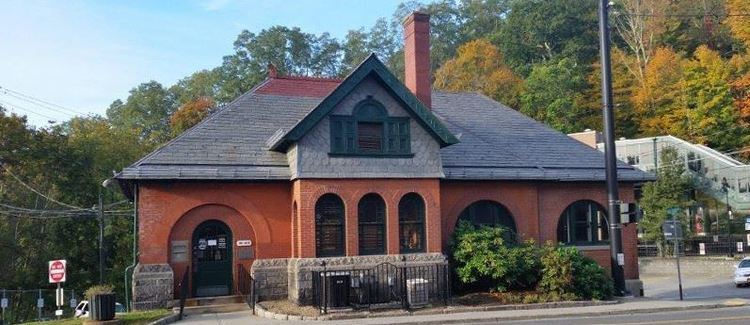
Post offices
The first "South East" post office was established in 1797, when the town was still a municipality in Dutchess County. On June 12, 1812, the county of Putnam was established from six Dutchess County towns: Carmel, Kent, Patterson, Philipstown, Putnam Valley and Southeast. These two dates provide a frame of reference for the dates of operation of each Southeast post office.
Before the establishment of centralized post offices, local offices were established in general stores, railroad depots and other public venues in densely populated areas. In Southeast, there were nine individual post offices, each with distinctive postmarks:
By September 1968, the last of these local offices was closed, and the only post office for the town of Southeast and village of Brewster was located at 20 Main Street with the postmark "Brewster, New York 10509". In the 1990s this USPS branch relocated to 3 Mount Ebo Road in the Doansburgh section of Southeast, no longer in the village of Brewster, but retained the "Brewster 10509" name and ZIP code.
Geography
According to the United States Census Bureau, the town has a total area of 35.0 square miles (91 km2), of which 32.1 square miles (83 km2) is land and 2.9 square miles (7.5 km2), or 8.35%, is water. The town contains several reservoirs that supply New York City.
The east town line is the border of Connecticut (Fairfield County), and the south town line is the border of Westchester County.
Demographics
As of the census of 2000, there were 17,316 people, 6,184 households, and 4,569 families residing in the town. The population density was 540.1 people per square mile (208.5/km²). There were 6,412 housing units at an average density of 200.0 per square mile (77.2/km²). The racial makeup of the town was 92.88% White, 1.87% African American, 0.14% Native American, 1.63% Asian, 0.09% Pacific Islander, 2.40% from other races, and 0.99% from two or more races. Hispanic or Latino of any race were 8.04% of the population.
There were 6,184 households out of which 37.5% had children under the age of 18 living with them, 61.9% were married couples living together, 8.7% had a female householder with no husband present, and 26.1% were non-families. 20.6% of all households were made up of individuals and 6.5% had someone living alone who was 65 years of age or older. The average household size was 2.77 and the average family size was 3.22.
In the town, the population was spread out with 26.4% under the age of 18, 5.9% from 18 to 24, 33.1% from 25 to 44, 24.6% from 45 to 64, and 10.0% who were 65 years of age or older. The median age was 37 years. For every 100 females there were 101.6 males. For every 100 females age 18 and over, there were 97.2 males.
The median income for a household in the town was $69,272, and the median income for a family was $78,553. Males had a median income of $51,957 versus $39,583 for females. The per capita income for the town was $29,506. About 3.1% of families and 6.1% of the population were below the poverty line, including 8.3% of those under age 18 and 3.8% of those age 65 or over.
Government
The Town of Southeast is governed by a town board. Southeast Town Hall is located on New York State Route 22 in Brewster, New York. Law enforcement services for Southeast are provided by the New York State Police and the Putnam County Sheriff's Department. The village of Brewster, New York has its own police department.