
Length 560 km | ||
 | ||
- average 5,400 m/s (190,699 cu ft/s) | ||
The Branco River (Portuguese: Rio Branco; Engl: White River) is the principal affluent of the Rio Negro from the north. It is enriched by many streams from the Tepui highlands which separate Venezuela and Guyana from Brazil. Its two upper main tributaries are the Uraricoera and the Takutu. The latter almost links its sources with those of the Essequibo.
Contents
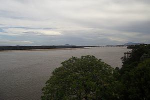
Map of Branco River, State of Roraima, Brazil
The Branco flows nearly south, and finds its way into the Negro through several channels and a chain of lagoons similar to those of the latter river. It is 350 miles (560 km) long, up to its Uraricoera confluence. It has numerous islands, and, 235 miles (378 km) above its mouth, it is broken by a bad series of rapids.
The river is referred to as "branco" (white) because of inorganic sediments carried in the water. Alfred Russel Wallace mentions this peculiar coloration in "On the Rio Negro," a paper read at the 13 June 1853 meeting of the Royal Geographical Society, in which he says: "[The Rio Branco] is white to a remarkable degree, its waters being actually milky in appearance." Alexander von Humboldt attributed the color to the presence of silicates in the water, principally mica and talc. There is a visible contrast with the waters of the Rio Negro at the confluence of the two rivers, the Rio Negro's waters being darkened by suspended organic debris containing tannin and humic acid.