
 | ||
Early permian post glacial bivalve faunas of the itarar group paran basin
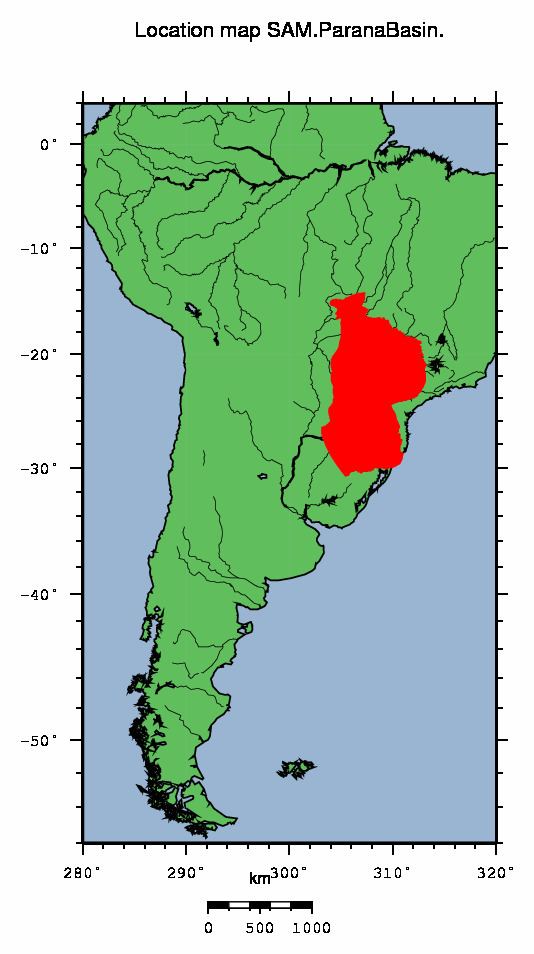
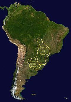
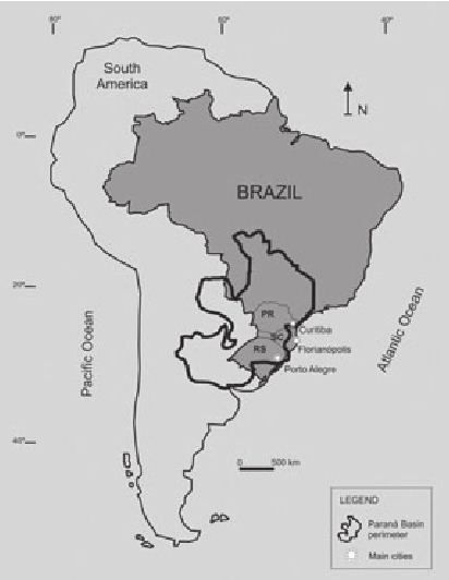
The Paraná Basin is a large sedimentary basin situated in the central-eastern part of South America. About 75% of its areal distribution occurs in Brazil, from Mato Grosso to Rio Grande do Sul states. The remainder area is distributed in eastern Paraguay, northeastern Argentina and northern Uruguay. The shape of the depression is roughly elliptical and covers an area of about 1,500,000 km2 (580,000 sq mi).
Contents
- Early permian post glacial bivalve faunas of the itarar group paran basin
- Pioneer studies
- Basin evolution
- Stratigraphy
- References
The Paraná River, from which the Paraná Basin derived its name, flows along the central axis of the Paraná Basin and drains it.
Pioneer studies
The first study on the Brazilian side of the Paraná Basin dates from 1841, when a Brazilian Imperial Government Mission prospected for coal. Turning point in the basin's geological understanding was the "White Report", published in 1908 by the American geologist Israel C. White, head of the "Comissão de Estudos das Minas de Carvão de Pedra do Brasil" (Commission for Studies on Brazilian Coal Mines). One of the main results of these studies, besides the reconnaissance for coal, was the discovery of Mesosaurus fossils within Permian black shales (Irati Formation), and the Glossopteris flora within the Permian coals. White was one of the first to propose the equivalence between the South American Permian strata and similar rocks of the Karoo Basin in South Africa.
Basin evolution
The basin developed during the Paleozoic and the Mesozoic with a sedimentary record comprising rocks from the Ordovician right up to the Cretaceous, thus spanning the time interval between 460 and 66 million years. The maximum thickness of the infill reaches 7,000 m in its central area and is composed of sedimentary and igneous rocks. The sedimentary cover extends across various Precambrian geologic provinces: the Río de la Plata Craton, the Mantiqueira Province, the Luis Alves craton fragment, the Tocantins Province and the Paranapanema block. This last province is distinct in that it is wholly covered be basin sediments and therefore poorly known.
The Paraná Basin is a typical intra-cratonic flexural basin, although during the Paleozoic it was a gulf that opened to the southwest. The basin genesis is related to the convergence between the former Gondwana supercontinent and the oceanic crust of the former Panthalassa ocean. The basin formed, at least during the Paleozoic orogenesis of the Gondwanides, a foreland basin.
Stratigraphy
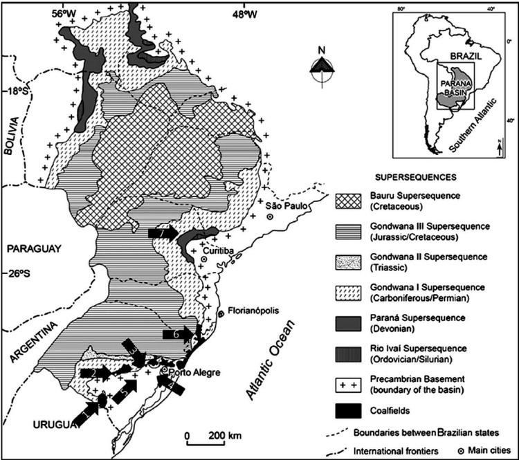
The sedimentary column of the Paraná Basin was divided by Milani, 1997, into six second order allostratigraphic supersequences (in the sense of Vail, 1977). These sequences define the stratigraphic framework of the basin and are bound by distinct depositional hiati, caused by erosive events.
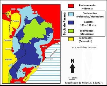
Rio Ivaí Supersequence: The basal supersequence, deposited during the Late Ordovician to Early Silurian, is constituted by three formations: Alto Garças Formation composed mainly of sandstones, Rio Ivaí Formation, represented by glacial Ordovician deposits that affected large areas of Gondwana and the Vila Maria Formation, a thick muddy sequence rich in fossil content: graptolites, trilobites, brachiopods and chitinozoa.
Paraná Supersequence: This Devonian supersequence is represented, at the base, by sheet-like, cross-bedded coarse to medium sandstones of the Furnas Formation and, on top, by a muddy section, rich in macrofossils and forming a potential petroleum source rock, named Ponta Grossa Formation.
Gondwana I Supersequence: The Carboniferous to Early Triassic Gondwana I Supersequence has two distinctive features:
Finally, during the Late Permian the Irati Formation was laid down, represented by bituminous shale, a potential petroleum source rock, and famous worldwide for its Mesosaurus fauna. The top of this supersequence defines the end of the marine phase.
Gondwana II Supersequence: This Triassic supersequence marks the beginning of continental sedimentation. It bears an important reptile and mammal fauna, that can be correlated to the African continent.
Gondwana III Supersequence: The Late Jurassic to Early Cretaceous Gondwana III Supersequence is marked by two major events:
Bauru Supersequence: A Cretaceous supersequence occurring in the north-central part of the basin and composed mainly of sandy-conglomeratic deposits.