
Country | ||
 | ||
Languages spoken | ||
Map of Panihati
Panihati is a place in north Kolkata and a municipality under Khardaha / Ghola police stations under Barrackpur City Police of Barrackpore subdivision. in Kolkata in the Indian state of West Bengal. It is a part of the area covered by Kolkata Metropolitan Development Authority.
Contents
Tmc wins in panihati municipality
Geography
Panihati has an average elevation of 13 metres (42 feet).
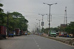
Panihati covers two important railway stations from Sealdah north main section line - 1) Sodepur - a densely populated urban city connected to the northern side of Kolkata by Barrackpore Trunk Road and with Barasat via Sodepur Road through Madhyamgram. 2) Agarpara — which shares its borders with Kamarhati and North Dumdum Municipality. Panihati Municipality is located on BT Road, Kolkata - 700110 at the western side of Sodepur Rail station.
Demographics
As of 2001 India census, Panihati had a population of 348,379. Males constitute 52% of the population and females 48%. Panihati has an average literacy rate of 82%, higher than the national average of 74.4%: male literacy is 85%, and female literacy is 79%. In Panihati, 8% of the population is under 6 years of age.
Healthcare
North 24 Parganas district (under Kolkata Metropolitan area)has been identified as one of the areas where ground water is affected by arsenic contamination. The famous scientist Kishori Mohan Bandyopadhyay who had assisted Ronald Ross in his malaria research work and was awarded a Gold Medal in 1903 for his pioneering work by King Edward VII of Britain was a resident of Panihati.