
Established January 6, 2009 | Area 1.27 million km² | |
 | ||
Created January 6, 2009 (2009-January-06) Administrator Laura Beauregard, Superintendent, U.S. Fish and Wildlife Service Website Pacific Remote Islands Marine National Monument Management United States Fish and Wildlife Service | ||
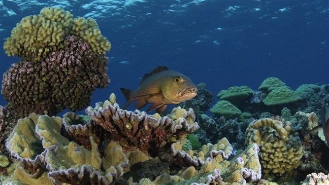
The Pacific Remote Islands Marine National Monument is a group of unorganized, mostly unincorporated United States Pacific Island territories managed by the Fish and Wildlife Service of the United States Department of the Interior and the National Oceanic and Atmospheric Administration of the United States Department of Commerce. These remote refuges are "the most widespread collection of marine- and terrestrial-life protected areas on the planet under a single country's jurisdiction". They protect many endemic species including corals, fish, shellfish, marine mammals, seabirds, water birds, land birds, insects, and vegetation not found elsewhere.
Contents
- Map of Pacific Remote Islands Marine National Monument United States Minor Outlying Islands
- History
- Location and area
- Climate
- Population
- References
Map of Pacific Remote Islands Marine National Monument, United States Minor Outlying Islands
History
The Pacific Remote Islands Marine National Monument was proclaimed a national monument on January 6, 2009, by U.S. President George W. Bush and follows his June 6, 2006, creation of the Papahānaumokuākea Marine National Monument in the Northwestern Hawaiian Islands. It was expanded on September 25, 2014 by U.S. President Barack Obama. The monument covers 490,343 square miles (1,269,980 km2), spanning areas to the far south and west of Hawaii: Kingman Reef, Palmyra Atoll, Howland Island, Baker Island, Jarvis Island, Johnston Atoll, and Wake Island. At Howland Island, Baker Island, Jarvis Island, Palmyra Atoll, and Kingman Reef the terrestrial areas, reefs, and waters out to 12 nautical miles (22 km; 14 mi) (radius) are part of the National Wildlife Refuge System. For Kingman Reef and Palmyra Atoll and Howland Island and Baker Island, fishery-related activities seaward from the 12 nmi (22 km) refuge boundaries out to the 50 nmi (93 km) NMM boundary (about 100 nmi (190 km) square across) are managed by the National Oceanic and Atmospheric Administration. For Jarvis Island, Johnston Atoll, and Wake Island fishery-related activities seaward from the 12 nmi (22 km) refuge boundaries out to the 200 nmi (370 km) NMM boundary (U.S. EEZ waters) are managed by the National Oceanic and Atmospheric Administration. The land areas at Wake and Johnston Atolls remain under the jurisdiction of the U.S. Air Force, but the waters from 0 to 12 nmi (22 km) are protected as units of the National Wildlife Refuge System. The entire monument is closed to commercial fishing and other resource extraction activities, such as deep sea mining.
The monument includes endemic trees, grasses, and birds adapted to life at the Equator; the rare sea turtles and whales and Hawaiian monk seals that visit Johnston Atoll; and high-quality coral reefs. U.S. federal law prohibits resource destruction or extraction, waste dumping, and commercial fishing in the monument areas. Research, free passage, and recreation are allowed.
On June 17, 2014, U.S. President Barack Obama proposed using his executive powers to expand the marine protected area to 782,000 square miles (2,030,000 km2). Sport fishing is exempt and public comments were solicited. He then signed a proclamation on September 25, 2014, designating the largest marine reserve in the world. The proclamation expands the existing Pacific Remote Islands Marine National Monument, one of the most pristine tropical marine environments in the world, to six times its current size, resulting in 490,343 square miles (1,269,982 square kilometers) of protected area around these tropical islands and atolls in the south-central Pacific Ocean. Expanding the Monument will more fully protect the deep coral reefs, seamounts, and marine ecosystems unique to this part of the world, which are also among the most vulnerable areas to the impacts of climate change and ocean acidification.
Location and area
The following islands form the basis of the Pacific Remote Islands Marine National Monument:
Climate
Because the islands are scattered throughout the ocean, the climate is different on each island. Baker, Howland, and Jarvis Islands have an equatorial climate, with scant rainfall, constant wind, and burning sun. Johnston Atoll and Kingman Reef have a tropical climate, but are generally dry, with consistent northeast trade winds with little seasonal temperature variation. Palmyra Atoll has a hot, equatorial climate. Because the atoll is located within the low pressure area of the Intertropical Convergence Zone where the northeast and southeast trade winds meet, it is extremely wet with between 4,000–5,000 mm (160–200 in) of rainfall each year.
Population
The islands have no indigenous inhabitants. Wake has a population of ca. 125 military personnel and contractors. Johnston Atoll had a peak population of 1,100 military and civilian contractor personnel in 2000, but it was evacuated by 2007. Since 2010, volunteer biologists staff the island in groups of 5. Four to twenty Nature Conservancy and U.S. Fish and Wildlife staff live at Palmyra Atoll. The four other islands are usually uninhabited.
Public entry to the islands is by special-use permit from U.S. Fish and Wildlife Service, and is generally restricted to scientists and educators. Only Wake Island, Palmyra Atoll and Johnston Atoll have serviceable runways; Jarvis, Baker and Howland Islands had airstrips in earlier times but they have since been abandoned and are no longer operational.