
Length 40 mi (64 km) NNW-SSE Topo map USGS Cinnabar Mountain Country United States of America | Parent range Owyhee Mountain Range Elevation 2,561 m | |
 | ||
Similar Leslie Gulch, Deer Flat Upper Embankment, Celebration Park, Swan Falls Dam, Owyhee Dam | ||
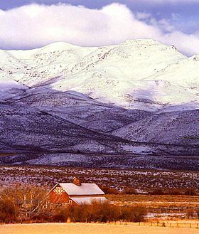
Owyhee mountains idaho upland scenic byway
The Owyhee Mountains are a mountain range in Owyhee County, Idaho and Malheur County, Oregon.
Contents
- Owyhee mountains idaho upland scenic byway
- Map of Owyhee Mountains Idaho 83650 USA
- 4x4 trip to lost trail in the owyhee mountains idaho
- References
Map of Owyhee Mountains, Idaho 83650, USA
Mahogany Mountain and the associated volcanic craters of the Lake Owyhee volcanic field are in the Owyhee Mountains of Oregon just east of the Owyhee Reservoir on the Owyhee River.
The southeastern end of the range including the old mining area west of Silver City is referred to as the Silver City Range. About 8.3 kilometres (5.2 mi) west of Silver City is the De Lamar ghost town in Jordan Creek below the mine workings on De Lamar Mountain to the south. The area was active in the late 1880s. In the 1970s mining began again with the development of open pit silver–gold mines on De Lamar Mountain.
4x4 trip to lost trail in the owyhee mountains idaho
References
Owyhee Mountains Wikipedia(Text) CC BY-SA