
Country Algeria Time zone CET (UTC+1) Population 6,830 (2008) | Elevation 95 m (312 ft) Area 712 km² | |
 | ||
Oued El Alenda (Arabic: وادى اﻟﻌﻠﻨﺪة) is a town and commune in Mih Ouensa District, El Oued Province, Algeria. According to the 2008 census it has a population of 6,830, up from 5,839 in 1998, with an annual growth rate of 1.6%. The town is 17 kilometres (11 mi) southwest of the provincial capital El Oued, on the N16 highway connecting it to Touggourt.
Contents
Map of Oued El Alenda, Algeria
Climate
Oued El Alenda has a hot desert climate (Köppen climate classification BWh), with very hot summers and mild winters. Rainfall is light and sporadic, and summers are particularly dry.
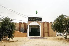
Education
4.3% of the population has a tertiary education, and another 13.0% has completed secondary education. The overall literacy rate is 75.5%, and is 83.2% among males and 67.2% among females.
Localities
The commune of Oued El Alenda is composed of seven localities: