
Surface area 4,046 acres (16.37 km) Area 16.37 km² Surface elevation 363 m Cities Cooperstown | Catchment area 74 sq mi (190 km) Max. length 7.8 miles (12.6 km) Max depth 51 m Length 14.5 km Islands Sunken Island | |
 | ||
Location Otsego County, New York,United States | ||
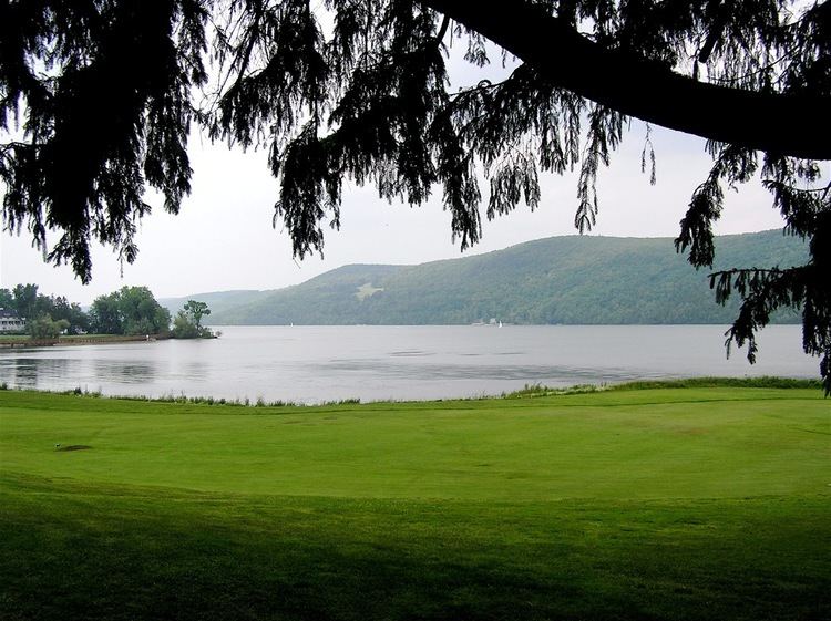
Otsego Lake is a 4,046-acre (16.37 km2) lake located in Otsego County, New York and is the source of the Susquehanna River. The Village of Cooperstown is located at the lake's southern end. Glimmerglass State Park is located on the lake's northeastern shore, and includes Hyde Hall, a large mansion constructed in 1817 that overlooks the lake. Glimmerglass Opera is located on the western shore.
Contents
- Map of Otsego Lake New York 13326 USA
- DescriptionEdit
- Council RockEdit
- Sunken IslandEdit
- Three Mile PointEdit
- Fairy SpringsEdit
- Appearances in literatureEdit
- References
Map of Otsego Lake, New York 13326, USA
The name Otsego is from a Mohawk or Oneida word meaning "place of the rock", referring to the large boulder near the lake's outlet, today known as "Council Rock".
DescriptionEdit
Otsego Lake is 7.8 miles (12.6 km) long with a surface area of 4,046 acres (16.37 km2). Its average depth is 82 feet (25 m), with a maximum depth of 167 feet (51 m). Portions of the lake are within the towns of Springfield, Middlefield and Otsego.
It is geologically related to the Finger Lakes but is not counted among them. One difference is that Otsego Lake is situated at a higher elevation (1,191 feet [363 m]) than the Finger Lakes (approximately 400 feet [122 m]).
Council RockEdit
Located near the shore of Otsego Lake in Cooperstown is Council Rock, a large boulder whose top is above the water's surface and can be seen from shore. At low water, the oval rock rises approximately 4.5 feet (1.4 m) above the water, and is about nine feet (2.7 m) long by six feet (1.8 m) wide. It is believed to have been a meeting place for Native Americans prior to the American Revolutionary War.
A small parcel of land near Council Rock was presented to the Village of Cooperstown in 1957, on the condition that it remain open to the public as a park. The park, today known as Council Rock Park, also includes a set of concrete steps leading to a lake-level terrace that was built in 1937.
Sunken IslandEdit
Sunken Island is a submerged sandy plot located near the western shore of Otsego Lake, approximately seven miles (11 km) from Cooperstown. It is the supposed remains of an island described in the writings of James Fenimore Cooper upon which a structure once stood. Today Sunken Island is several feet below the surface of the lake and is cordoned off to prevent boats from running aground.
Three Mile PointEdit
Three Mile Point is a public swimming beach located three miles from Cooperstown along the western shore of Otsego Lake accessible via state highway 80. It is open during the summer and offers changing rooms, a picnic area, and a pavilion.
Fairy SpringsEdit
Fairy Springs is a public swimming area located one mile from Cooperstown along the eastern shore of Otsego lake accessible via county road 31. It is open May through September and offers changing rooms, a picnic area, and a pavilion.
Appearances in literatureEdit
The lake was known to James Fenimore Cooper as Glimmerglass and was a principal feature in his novels The Pioneers and The Deerslayer, in which local landmarks such as Council Rock and Sunken Island are mentioned.
Otsego Lake is also referenced in The Secret of Mirror Bay, a novel in the Nancy Drew Mystery Stories series.