
Car plates NOS | Area 1,765 km² | |
 | ||
Gminas Total 9 (incl. 1 urban)OstródaGmina DąbrównoGmina GrunwaldGmina ŁuktaGmina MałdytyGmina MiłakowoGmina MiłomłynGmina MorągGmina Ostróda Points of interest Zamek Krzyżacki, Pole Grunwaldzkie, Dylewska Góra, Pole Bitwy pod Grunwald, Park Collisa Destinations | ||
Ostróda County (Polish: powiat ostródzki) is a unit of territorial administration and local government (powiat) in Warmian-Masurian Voivodeship, northern Poland. It came into being on January 1, 1999, as a result of the Polish local government reforms passed in 1998. Its administrative seat and largest town is Ostróda, which lies 37 kilometres (23 mi) west of the regional capital Olsztyn. The county contains three other towns: Morąg, 25 km (16 mi) north of Ostróda, Miłakowo, 34 km (21 mi) north of Ostróda, and Miłomłyn, 12 km (7 mi) north-west of Ostróda.
Contents
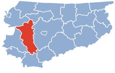
Map of Ostr%C3%B3da County, Poland
The county covers an area of 1,764.89 square kilometres (681.4 sq mi). As of 2006 its total population is 105,286, out of which the population of Ostróda is 33,419, that of Morąg is 14,497, that of Miłakowo is 2,665, that of Miłomłyn is 2,305, and the rural population is 52,400.
Neighbouring counties
Ostróda County is bordered by Lidzbark County to the north-east, Olsztyn County to the east, Nidzica County to the south-east, Działdowo County to the south, Iława County and Sztum County to the west, and Elbląg County to the north-west.
Administrative division
The county is subdivided into nine gminas (one urban, three urban-rural and five rural). These are listed in the following table, in descending order of population.