
Time zone EET (UTC+2) Vehicle registration 19 Local time Monday 4:51 PM | Postal code 19500 Climate Cfb Area code 364 | |
 | ||
Weather 9°C, Wind NE at 11 km/h, 78% Humidity | ||
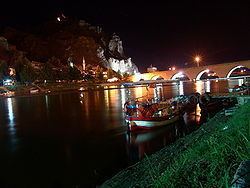
Osmancık is a district of Çorum Province in the Black Sea region of Turkey, located 59 km north of the city of Çorum.
Contents
- Map of OsmancC4B1k 19500 OsmancC4B1k2FC387orum Province Turkey
- Geography
- List of Neighborhoods
- History
- Notable natives
- Places of interest
- References
Map of Osmanc%C4%B1k, 19500 Osmanc%C4%B1k%2F%C3%87orum Province, Turkey
Geography
Located on an important crossing of the River Kızılırmak on the ancient Silk Road to the orient, Osmancık has long had a strategic value, and is still today a popular stopping-place on the road from Istanbul to the Black Sea city of Samsun and further east.
Today, Osmancık is known for its rice production, being especially suitable for a new strain of rice developed especially for the region by the Turkish Ministry of Agriculture and named "Osmancık-97."
The North Anatolian Fault zone runs through the valley, making Osmancık very vulnerable to earthquakes.
List of Neighborhoods
History
The area was settled by the Kayı clan of the Oghuz Turks as they migrated westwards into Anatolia from their heartland of Central Asia. Osmancık was one of the important destination points in the Ottoman period. Because of a number of earthquakes the city could not keep its ancient architecture. In the last century, there have been 4-5 heavy earthquakes. Being on the path of the Kızılırmak made the city an important settlement point since early history. Osmancık was known as "Pimolisene" during Roman and Byzantine eras.